
Curtis Fields - Dorsetforyou.com
APPLICATION NO: WP/14/00777/OUT 1st April 2015 Outline planning permission (with all matters being reserved including access) for the development of approximately (up to) 500 residential dwellings in 3 phases (phases 2 to 4) CURTIS FIELDS LAND SOUTH OF, CHICKERELL ROAD, WEYMOUTH Betterment Properties (Weymouth) Ltd Case Officer: Darren Rogers FOR DECISION 1. SUMMARY RECOMMENDATION 1.1 Delegate to the Head of Planning (Development Management & Building Control) to grant outline planning permission subject to the completion of a Section 106 Agreement and subject to conditions. 2. PROPOSAL 2.1 This is an outline application for the further development of land known as Curtis Fields or Markham & Little Francis. It is made in outline form with all matters being reserved (including access) for the development of approximately (up to) 500 residential dwellings in 3 phases (phases 2 to 4). 2.2 Members will be aware that an application for a mixed use scheme (but mainly housing) on phases 1A (a detailed scheme) and 1B (outline) all accessed off Chickerell Road were refused in 2013 but following an appeal and public inquiry, an Inspector acting on behalf of the Secretary of State for Communities and Local Government allowed the appeal. That appeal scheme is now currently under construction and comprises as part of the detailed phase 1A : a ‘Class A1’ Retail & Convenience unit with 7 flats over, a ‘Class B1’ Commercial/Office unit with 12 flats, 64 residential units 2.3 Phase 1B comprised the development of a further 97 residential units together with associated highways, parking and landscaping. A reserved matters application for the ‘layout’, ‘scale’, ‘appearance, ‘access’, and ‘landscaping’ of phase 1B has been submitted and is under consideration. 2.4 The approved development therefore comprises a total of 180 residential units. 2.5 In support of the application, the following documents have been submitted: Planning Statement, Design & Access Statement, Transport Assessment/Travel Plan Tree Survey Report Of 2014 Update Survey Of Badger Activity Landscape Visual Impact Assessment Archaeological Field Evaluation Supplementary Planning Document Ecological survey Flood Risk Assessment and Drainage Strategy, Draft Section 106 Heads of Terms 2.6 Although an outline application the applicant has submitted a detailed Design and Access Statement which explains the proposals thus : Overview – This document is a Design & Access Statement to support an Outline Planning Application (with All Matters Reserved) to the shared services partnership of West Dorset District & Weymouth & Portland Borough Councils (WDWP) by Betterment Properties (Weymouth) Ltd for a Phase 2 to 4 development at ‘Curtis Fields’, also known locally as Markham & Little Francis, lands south of Chickerell Road, Weymouth, Dorset. 2.7 The overall aim of the document is to explain the design rationale behind the application and provide a written description and justification for the proposal to accompany the drawings. This has been undertaken in general terms related to an analysis of the site context and in more detail relating to the immediate context of the site. The overall Curtis Fields site comprises an area of approximately 38 hectares of pasture farmland and open space, including a local Site of Nature Conservation Interest (SNCI) to the south. The site is bounded by Chickerell Road to the North, Lanehouse Rocks Road to the West, with a local school and residential development associated to the East. To the South of the site are a cemetery, paddock and residential properties along Wyke Road. Phases 1 A and 1B to the north of the site were granted planning permission in January 2014 following an appeal. An outline master plan has been developed which subdivides the site into four potential development phases (Figure 2). The application site forms the southern parcels of land comprising Phase 2A, 2B, 3A, 3B and 4A. The layouts have been developed iteratively looking at the physical, economic, environmental and social requirements of the site. This proposed development would supply Weymouth with housing to meet the current shortfall, including much needed low cost starter and affordable homes and provide a viable delivery of houses for the future on a sustainable site. 2.8 Site & Landscape Appraisal The application site comprises an area of approximately 19 hectares of gently sloping pasture farmland and Hillside Urban Pasture which is substantially scrub. There are a number of redundant farm buildings south of Cockles Lane, currently used for grazing a small number of horses. The fields are substantially bounded by existing suburban residential properties which erode any rural character in these areas. Land to the North on Phases 1A and 1B have permission for residential development. Land immediately to the south is undeveloped. The land outside of the application site to the south is an SNCI approximately. The topography includes undulations and contains a number of small ponds which appear to have dried up. The Dorset AONB is located approximately 400m to the West of the site which will be unaffected by this development. Following submission of an Environmental Impact Assessment screening opinion request in June 2011, Weymouth & Portland Borough Council planning team confirmed on 18th July 2014 that “...the proposed development is not an EIA development within the meaning of the EIA Regulations..” The site “...is not within a sensitive area as defined by regulation 2(1) of the EIA regulations...” These factors help to ensure that the site is visually contained thereby minimising the likelihood of adverse visual impacts on the wider landscape 2.9 Landscape Designations & Baseline Survey The overall site is currently covered by policies set out within the Weymouth and Portland Borough Council Local Plan 2005. It is designated as an Area of Local Landscape Importance and Important Open Gap. The site also bounds a locally designated Site of Nature Conservation Interest, scheduled many years ago principally for its grass species. This is within the ownership of the applicant but does not form part of this application. The proposed concept masterplan for the site ensures that large areas of the overall site will remain undeveloped and will continue to be managed as open space. These open spaces will be focused on the southern, higher areas of the site maintaining visual impact of the development on the surrounding area. The character of the area around the site is fairly uniform, and has been classified as ‘Mid Twentieth Century Suburbs’. This area includes housing within Wyke, Lanehouse and Westham. These suburbs consist predominantly of two storey housing, mainly on estates, some of which were developed as mass Council Housing. The area also includes some areas of bungalows, together with supporting services such as local shops, filling stations, public houses and surgeries. Dwellings include terraces, detached and semi detached properties. Building materials and styles are generally not specific to the local area. 2.10 Topography A gentle gradient falls from the North West corner of the overall site to the South East and rises steeply to the Southern boundary. As with Phase 1, natural site gradients will be utilised as part of the Sustainable Urban Drainage Systems strategy which incorporates a number of green swales and green landscaped surface water attenuation ponds which will permit controlled discharge of surface water into the local drainage system. These will be sympathetically designed into the landscape and provide positive additions to the urban design strategy 2.11 Landscape Character Areas Two landscape character areas define the overall site. Low lying Urban pasture forms the northern most three fields of the site, which include the approved Phase1. Here the land is relatively flat, centred on a number of small drainage channels. The land is mainly improved grassland, surrounded by hedgerows that are generally poorly managed with a high proportion of Elms suffering from Dutch Elm Disease, many of which have been removed. The fields are all bounded by existing suburban residential properties. The second character area slopes upwards towards the southern end of the site and is classified as Hillside Urban Pasture. The topography includes undulations. There are a number of small ponds which have appeared to have dried up. The landscape in this area contains the highest percentage of scrub to be found on the site. The two most species rich fields are outside the application site within the locally designated SNCI. Hedgerows are generally poorly managed and overgrown, with a high proportion of dead Elms trees. Hedgerow tree planting could be used to reduce any visual effects on existing adjacent properties. 2.12 Mitigating Visual Effects on Landscape Character The site is well served with mature hedgerows and some wooded areas as described above. It is envisaged that an arboricultural appraisal will be undertaken to determine how to best visually integrate the new development with the surrounding landscape. Areas of open space will be retained and sufficient space allowed for provision of private gardens and street tree planting. The SNCI and POS will ensure the setting of the listed buildings 140-146-Wyke Road would not be adversely affected. The setting of Westdowne House has already been compromised by the construction of adjacent housing on Westdowne Close. Phase 1 housing and landscaping has been approved in this area. 2.13 Mitigating Effects on Movement The public footpaths running through the site would be retained and where appropriate would be accompanied by cycle routes. Additional pedestrian / cycle routes provided within the application site will link to the wider network would include, subject to agreement with external parties, with links to Roundhayes Close, Lanehouse Rocks Road, Markham Avenue and Cockles Lane. The development of the site offers the opportunity for enhanced permeability within the Lanehouse / Westham / Wyke Regis area, allowing greater access to local residents to local facilities both within the site and the surrounding area 2.14 Magnitude & Significance of Potential Visual Effects of Overall Site By retaining a swathe of open space along the southern part of the overall site, the proposed concept masterplan would maintain the identity of the built up areas of Lanehouse and Wyke Regis. The Theoretical Zone of Visibility shows that the majority of affected views into the site are from the north. These are generally either from the area immediately around the site boundary, or within the AONB up to 5km away as glimpsed views from the countryside between Weymouth and the route of the Southwest Coast Path. One finding of the LVIA by HED raised some concern on developing the higher southern ground of Phase 3B. With this in mind, Betterment propose to develop single storey bungalows within this area to mitigate against any potential unbroken view of development. The SNCI and land to the east and west of this would not be developed. The visual appraisal concludes that any visual effects to the visual receptors identified that the main visual effects are going to be predominantly limited to users and residents of the streets and properties immediately adjacent to the site boundaries, with glimpsed longer distance views from short stretches of neighbouring roads and smaller views from farther afield. As mitigation planting establishes, the development will integrate with the surrounding residential land uses and indeed soften into the landscape. A LVIA undertaken by HED forms part of this application. 2.15 Existing Site Access Phase 3B and the former ferry overflow car park may currently be accessed by vehicles via Cockles Lane and also provides access to the existing barn and outbuildings. The pedestrian right of way along Cockles Lane also affords private access only to the areas of Phase 2A and 2B. Two further pedestrian rights of way across the southern parcel of land provides links from Cockles Lane to Markham Avenue (to the east) and Wyke Road (to the south). The site may also be accessed privately from the access road to the rear of 111 Lanehouse Rocks Road, to the west of the site. Access from the north will eventually be formalised when the approved Phases 1A and 1B are built on site 2.16 Architectural Context Whilst a variety of architectural styles exist, the general form of the area is 2-storey housing with brick/render finishes and hipped tiled roofs. A large steel framed barn and remains of smaller associated derelict farm buildings on the application site are not suitable for reuse within Phase 3B. The proposed new development would be similar in scale, massing and style as those granted permission within Phase 1. The application site is surrounded by a variety of property types including 2-storey detached, 2 storey semi-detached and single storey bungalows. St Augustines school to the north east of Phase 4A is typically single storey. Properties to the West have occasional open spaces between with car parking forecourts to rear containing garage structures set back from the public footpath. Elements of this style could be incorporated into the site layout design to reduce the visual impact of street front parking. 2.17 Flooding Mitigation to prevent flooding within Phase 1 was been addressed within the grant of permission for Phase 1 and the FRA submitted by Nola Design. This same FRA addressed the entire site including Phases 2 to 4 of this application. As such, the same FRA forms part of this application. Extensive detailed Flood Reports and Fluvial Modelling were undertaken in liaison with the Environment Agency, Wessex Water, Dorset County Council and Weymouth Borough Council. This identified a requirement to undertake ground works to form a series of sensitively designed and landscaping surface water swales and balancing ponds to control the release of surface water run off in any detailed scheme. 2.18 Constraints & Opportunities The layout for the site seeks to identify opportunities to create integration and connection between the site and the existing development surrounding it, with the focus being on facilitating pedestrian and cycle routes which will be of benefit to both existing and new residents and will offer the most opportunity for effective integration between the new and existing communities. CONSTRAINTS • The existing topography • Need to contain manage localised surface water flooding • Residential properties located to both the East and West of application site • Green corridor of Cockles Lane • Likely extension of St Augustines School OPPORTUNITIES • Create a well designed residential development on a sustainable site, close to Weymouth town centre, close to areas of employment, close to public rights of way and green open space. • Minimise flooding immediately up and down stream from the site. • Provide connectivity and permeability across the site linking into existing established neighbourhoods 2.19 Public Consultation Proposals for the entire site in outline (and Phase 1 in detail) were exhibited for the local community in the form of a public consultation on all Phases including an indicative proposal for the proposed redevelopment of the entire site in June 2012. The consultation was held over two days and provided an opportunity for local residents and businesses to review initial proposals, engage with members of the development team, comment and contribute to refinement of the proposals. Following the delivery of 2,500 leaflets and a wider media campaign in the Dorset Echo and radio, approximately 300 people attended the event including local Councillors, taking time to consider and discuss the proposals with the development team with 142 forms received in total giving a response rate of approximately 50%. 142 feedback forms equates to only 5.68% of those directly invited to attend. Of these respondents 106 people (75%) were not in favour whilst 36 people (25%) were in favour of the proposed development. The three principal concerns arising from the written feedback forms received following the public consultation in order of ‘importance’ were; •the need to review the existing and proposed traffic implications around the site; • the need to address flooding both on and up/down stream from the site; •the need for a review of public service provision, particularly education & health 2.20 Masterplan Development The submitted site layout is based on the indicative layouts produced for the Public Consultation held in June 2012 and subsequently formed the formal Pre-Planning application submitted to Weymouth & Portland Borough Council (WPBC). The layout was produced based on the policies contained within the emerging WDWP draft Local Plan, alongside adopted and emerging national, regional and local planning policies, and feedback from the above consultations, including a possible extension of St Augustine’s school. The layout here forms part of the current planning application has taken into account feedback received at all previous design reviews, meetings with bodies such as DCC/DWT/EA etc, Public Consultation and feedback received from the LPA Pre-Application process. The layout has been designed taking into account physical, economic, environmental and social requirements of the application site, the larger overall site and the site context. As identified from the outset, the key set of masterplan and urban design principles are; Masterplan Provide low cost starter homes Incorporate ‘green’ streets and squares Minimise imposition of highways and parking Prevent flooding on and immediately off site Comply with incoming policies rather than out of date existing policies and Local Plan Urban Design Provide an inclusive development for members of society Ensure cross site permeability for pedestrian and cycle users 2.21 Overview The vision for the overall proposal is to provide a quality residential development, with an appropriate level of affordable housing and public open space with a mixed use component to contribute towards the existing local services. A comprehensive network of vehicular, pedestrian and cycle routes will be provided giving good access for both new and neighbbouring residents to the wider neighbourhood. The masterplan was produced based on the policies contained within the emerging WDWP draft Local Plan, alongside adopted and emerging national, regional and local planning policies and recent pre-application meetings and discussions. The layouts have been developed iteratively looking at the physical, economic, environmental and social requirements of both the site and the wider site. The proposal is based on the indicative layouts produced for the Public Consultation and the subsequent planning application for Phase 1. The detail shown within the Phase 1 application will act as an indicative design template for future detailed submissions on this site, whilst acknowledging any future development will be designed to meet the specific needs at the appropriate time. As identified from the outset, the key set of design principles are; Provide low cost starter homes Incorporate ‘green’ streets and squares Minimise imposition of highways and parking Prevent flooding on and immediately off site Comply with incoming policies rather than out of date existing policies Provide an inclusive development for members of society Ensure cross site permeability for pedestrian and cycle users 2.22 Scale & Skyline Adjoining developments principally comprise one and two storey properties with intermittent three storey units. The proposal seeks to continue this language by providing mostly two storey properties, with single storey flats over garages and three storey marker buildings at key locations throughout the site, to provide variety, design punctuation and a range of house types. Two storey housing have a typical ridge height of 8.5m whilst the 2.5/3 storey units have ridge heights of approximately 9.5m, depending upon the slope of the site. Development will follow the natural contours of the site stepping down the site respecting the property heights on adjoining lands. The scheme has been designed around the natural contours of the site and the landscaped open spaces which are a direct response to accommodate the on site contours and constraints. This has resulted in a lower housing density than would ordinarily be accommodated on a site but will ultimately provide a greener, better place in which to live. The scale, massing, density and appearance of the proposed scheme is light and will compliment the adjoining developments. 2.23 Proposed Use & Quantity The proposal is for a residential development of approximately (up to) 500 dwellings. They will be predominately family housing with some flats and flats over garage. Bungalows will be incorporated into the higher ground within Phase 3B to the south of the development. This is an acceptable use proposal for the area given the existing residential setting and ‘local centre’ on Chickerell Road at the Fiveways junction. 2.24 Appearance & Layout The applicant is focused on creating high quality units, which are of an appropriate design, and use materials which are appropriate to the location, whilst being aware of the local authorities desire to ‘not create another Poundbury’. Macro Concept The scheme proposes to create areas of sometimes distinct and contrasting character thought the development, in part achieved by variations in the streetscape/landscape and in part by subtle variations in the form and appearance of the individual units or groups of housing units. The streetscape will be constructed to incorporate traffic calming principles of short winding sections of road linking formal, informal squares and open spaces each having their own shape and size. The presence of swale features and balancing ponds within the streetscape will provide additional landscaping features and experiences. These character areas create visual identity which may reinforce ownership values and aid the simple navigation of the site and will become more apparent with the delivery of each future phase of housing across the overall site. The surrounding varied residential developments are characteristic of era specific mass market housing, an element this proposal reflects wth current housing for the general market. Mezzo Concept One character area may be different to its neighbours by the pre-dominant use of a single facing material such as the same red brick along with other subtle variations. The treatment and form of one square will be different from the next. Feature buildings mark out prominent buildings on squares, vistas or important junctions or transition points, for example on the route to the bridge or at the end of a terrace. The feature buildings need not be overtly different from their neighbours but may simply have a contrasting facing material such as render where its neighbours are brick, or alternatively the feature may be marked by a variation in height or architectural style and or detail Micro Concept Individual units will also have their own character be it in the form of different facing materials fenestration or simply the colour of the front door or the landscaping of the front garden in a simple terrace. Character areas will become more apparent with future development phases across the remainder of the site. The scheme draws on a number of contributing factors including existing and proposed landscape features, highways design and architectural built forms to generate a series of spaces and experiences that help to make the scheme site specific with some unique features in contrast to the character of the surrounding townscape. The main palette of materials draws from the contextual palette, being red brick, white and coloured render, and timber panels. A variety of tiled and slate roofs will be used throughout on both gabled and hipped roofs with brick and rendered chimneys. Doors and windows and soffits will be white, whilst both white and black rainwater goods will be used depending upon the facing material used. Brick detailing and arches will be used as a contrast with brick corbels and banding with rendered facades. Entrances will be sheltered with lean to and tiled pitched canopies. The site is currently very green and part of the proposal is to retain a green corridor through the development by utilising open landscaped swales as the sustainable urban drainage scheme. Cockles Lane forms an existing Green Route through the overall site. The intention is to develop landscaping along and to each side of Cockles Lane inline with the master plan for the overall site which seeks to keep Cockles Lane as an informal tree lined pedestrian and cycle route through the site which will link with the landscaped primary north south route. The site has some significant topography so the layout seeks to work with that topography to create attractive vista’s, retain significant views, and provide active management of some of the issues created by that landscape such as drainage. The layout is carefully constructed to not only manage its own drainage requirements, but also allow better management of those created by development upstream of the site. 2.25 Traffic Calming A variety of tools will be incorporated into the layout design to directly control and reduce the speed of vehicle throghout the development inline with the recommendations contained within the DCC Highway Guidance for Estate Roads. The main access road will wind through the sloping site naturally reducing traffic speeds. Careful positioning of buildings reduces not only each length of highway but also limiting forward visibility. Junctions will have reduced radii to lower the speed of vehicles, and squares are shared surface speed tables with ramped approaches. The width of highways will be reduced in width at a number of locations preventing two cars from passing thereby reducing traffic speed. 2.26 Highways, Materials & Adoption All highways will be designed in consultation with DCC and the applicants design team. The i-Transport Traffic Assessment shows Chickerell Road has capacity to accommodate the housing proposed within Phase 1 whilst providing safe access and egress to the site, which has been agreed in principle with Dorset County Council Highways. The masterplan shows an indicative layout of highways and footpaths. All materials will be easy to maintain, fit and safe for purpose, durable, sustainable and appropriate in character for the development. This includes not only the hard landscaping but also the soft landscaping and planting. 2.27 Green Routing Linked to the principles of connection & integration is the development of green routes through the site. The drainage requirements for the provisions of swales, and the existing tree lined historic route (Cockles Lane) through the site permit the perfect opportunity to create a green and connected environment which will provided by familiarity (through the integration of Cockles lane), environmental benefits (through the introduction of native trees and plants – the previous Elm population has been destroyed by disease), and manage flood risk, a wider issue for Weymouth (through use of Swales as part of a wider drainage management programme to reduce current problems further down stream, which may be reviewed in the final FRA). A strategically planned and delivered network of high quality green spaces will provide a wide range of benefits and multi functional resources. 2.28 SNCI Although the SNCI does not form part of this application, a landscaped buffer zone will be provided around the perimeter of the SNCI which will link to the larger POS provision, which could include provision for dog walkers and information boards outlining the importance of the site. 2.29 Wildlife Badgers have been recorded across the entire site. Please refer to the report prepared by Julian Brown Consultancy as part of this application. As a mitigation strategy, green wildlife corridors will be incorporated to facilitate the existing movements of badgers and sett relocation where required. Bird and bat boxes will be provided within the fabric of new buildings where feasible, whilst surface mounted boxes will be offered to all potential residents. Owl boxes are likely to form part of the strategy if present on site - please refer to the Ecology report as submitted with this application prepared by Fieldwork Ecology. Street lighting along edges of public open spaces and any proposed along Cockles Lane will be mostly low level pavement lighting or focussed beam street lighting to ensure bats continue to use this habitat post development. 2.30 Landscape The site has some significant topography so the layout will seek to work with that topography to create attractive vista’s, retain significant views, and provide active management of some of the issues created by that landscape such as drainage. The layout will be carefully constructed to not only manage its own drainage requirements, but also allow better management of those created by development upstream of the site. 2.31 Relatable Landscape Scale & Layout The layout will focus on creating a residential environment of an appropriate scale, using streets which focus on people not the car, with the ‘home zone’ type environment very much the focus. The layout will seeks to reduce the visual and practical dominance of parking and connect individual homes with public space. The landscaping of the site will be focused around the green route and SUDS requirements of the site, with a focus on the reinforcement of existing green routes such as Cockles Lane, reinforcement of existing perimeter boundaries, integrating high quality swale design into the streetscape, and place making around any public open space. Very few trees are present on site (please refer to the Arboricultural Report which forms part of this application) but replacement trees and shrubs will also provide further mitigation for any removed to facilitate the development. Larger specimen trees will be planted within the squares with smaller species linking these spaces along the primary highways. These will also provide scale within the street scene along the green swales. 2.32 TPO’s & Boundary Planting The Arboricultural survey and report which forms part of the application shows any trees covered by Tree Preservation Orders are in a New Group TPO near the junction of Cockles Lane and Roundhayes Close, to the northern boundary of Phase 2B. Most other trees on site have been identified as being dead, dying or in poor condition. Existing hedgerows to the perimeter of the site will be maintained and reinforced where appropriate. Much planting is located on adjoining properties outside of the application site and a piecemeal approach to reinforcement will be required as part of an on site undertaking. The existing hedgerow along Lanehouse Rocks Road will be retained and maintained for its entire length where feasible to screen the development. This will aid the concealment of parking to the flats over the Shop unit. The hedge could be supplemented with larger specimen trees which will be in keeping with the species type and scale of the existing adjoining trees and the scale of the proposed junction. 2.33 Planting Proposed new trees for the site will include native species fruit and flowering trees to add a diverse range of planting and environments for residents to enjoy. Shrubs will be selected for their contribution to wildlife enhancement and seasonal benefits, ensuring value for birds, bats and wildlife. Properties fronting streets and paths will receive low level railings and evergreen hedges providing defensible spaces to the fronts of properties. Shrub planting will be used through the parking courts and secondary routes. 2.34 Ecology & Bio-Diversity An ecological survey has been carried out by Fieldwork Ecology (which forms part of this application ) reporting on mitigation requirements where required. Briefly, the ecology of the site will be enhanced by the provision of new soft landscaping and planting schemes. An LPA Environmental Impact Assessment Screening Opinion dated 18th July 2014 confirmed an EIA Statement is not required for these works. 2.35 Balancing Ponds Surface water run off will be managed utilising SUD’s methods such as balancing ponds, swales and permeable paving. Although a SuDs mechanism, an option to explore the possibility of ensuring the base of some balancing ponds are kept ‘permanently’ wet to provide improved biodiversity and development mitigation will be explored. Whilst the ponds will be relatively shallow, the perimeter of each ponds will receive a variety of deterrent treatments including thorny ‘defensible’ planting, low level timber fencing, gabion walls and timber knee rails. Discreet timber information panels will be erected giving depth of water, maximum slope of pond sides and types of wildlife expected. Within future phasing it is expected any pond located within proximity of St.Augustines school could be utilised as part of a schools bio-diversity programme with the DCC Ecologist and Schools Improvement Team. 2.36 Swales Landscaped swales are also proposed for the site employing the natural site contours as a principal feature of the SUDS strategy. The swales and balancing ponds are all part of the SUDS scheme and will be maintained by a management company in perpetuity. Should Dorset County Council look to adopt these facilities in the future, the applicant would look to work with them. The River and Flood Consultant Engineers developed proposals following meetings with the Environment Agency and Dorset County Council that support the FRA and SUDS works. The Landscaping component of these areas will in turn have to be developed and agreed with DCC prior to adoption. 2.37 Access External Approach The applicant is committed to delivering accessible buildings and environments for as many .footpaths. All public footpaths will be designed to be stepfree including across all foot bridges with unobstructed sightlines. Given the scale of the overall development each Phase will be designed and constructed in accordance with the Building Regulations current at the time. Presently, Part M governs ‘Access’ within the Regulations to ensure inclusive design for disabled parties. A new vehicular access off Lanehouse Rocks Road has been identified as a suitable access point for vehicular movements into the application site. Although it has been demonstrated the Chickerell Road access to Phase 1 could adequately support all phases of development proposed with this application, the Lanehouse Rocks Road junction will alleviate any possible pressure on the Chickerell Road and also Fiveways junctions. A further vehicular access is proposed to the east off Markham Avenue which will serve a development parcel. Pedestrian and cycle links from the same location will provide improved links to the wider scheme. The development also proposes to improve cross site permeability for sustainable transport methods via new pedestrian and cycle routes to the East into Roundhayes Close, Markham Avenue, and to the west onto Cockles Lane and Lanehouse Rocks Road. These are explored in more detail by i-Transport in their documentation submitted with this application. Vehicular routes across the site will comprise a hierarchy of primary and shared surface secondary routes. We have undertaken detailed traffic assessments for the application site and on this basis have developed junction designs that will facilitate appropriate levels of access and support the vehicular movements generated by the site. Following consultation with Dorset County Council Highways Team we are focusing on a pedestrian led scheme which facilitates car movement and appropriate parking, but which does not allow them to dominate the highway. This is particularly critical as the highway also incorporates many of the landscaping and drainage feature elements that are so critical to both the functionality and character of the emerging scheme. The emerging scheme also seeks to integrate with the surrounding area by developing pedestrian and cycle access points from surrounding development to facilitate through routes and create opportunities to access facilities such as the school and public open space without need to walk along busy vehicular routes. Full access to all properties is provided for emergency services. At the Public Consultation, a local undertaker also queried the same point given many developments are not accessible. All highways and footpaths are to be designed and constructed with the Consultant team to meet the criteria set out within Part M of the Building Regulations. Internal Movement All housing within the development will be designed and constructed to accommodate adequate provision for wheelchair access and circulation and provision for future installation of stair lifts and vertical passenger lifts in line with the Lifetime Homes criteria. 2.38 Transport Links & Amenities The area is well served by schools, but feedback from the Public Consultation confirmed schools were at their upper limit in terms of pupil numbers. Since the Consultation, we have liaised with planning officers and Mr Ed Denham of DCC Children’s Services Premises Team to discuss the expansion of St Augustines school which adjoins the site. As such, a parcel of land has been incorporated into the indicative masterplan to allow for a school expansion programme inline with that tabled by DCC in April 2014. A large children’s playground exists to the west of Phase 1 to which a public right of way is being provided. This pedestrian and cycle link will also provide access to the existing doctors surgery on Ludlow Road. New pedestrian, cycle and vehicle links will also provide access to the Tesco Express, petrol station and Wessex Pharmacy on Lanehouse Rocks Road. A chip shop and tool hire centre are located near the Five Ways junction to the north of the site, with a laundrette, dry cleaners and hairdressers some 350m to the west. Two pubs on Chickerell Road are within approximately 600m of the site whilst the nearest post office is approximately 800m to the east on Abbotsbury Road. Phase 1 will deliver a new convenience store run by a national operator and a separate building will deliver a limited level of office space. Major bus routes operate along both Chickerell and Lanehouse Rocks Road which reinforces the sustainable nature of the site. The routes also provides links to employment areas including Granby Industrial Estate and Portland. New landscaped public footpaths will be provided through the development which deviate away from the highway edge providing a pleasant pedestrian link to the major bus routes. To reduce car dependency further, all dwellings will be provided with secure storage for bicycles. 2.39 Surveillance Where parking courts are provided, adjoining properties will be designed to have windows overlooking these areas to provide natural surveillance. Properties adjoining public footpaths across the site will be orientated to face or have windows overlooking these areas. 2.40 Refuse Storage & Collection As with Phase 1, it is proposed housing will be provided with storage areas suitable to cater for the requirements of any ‘Dorset Waste Partnership’ scheme at the time. Highways will be designed to an adoptable standard to permit access by a Local Authority refuse lorry. 2.41 Storage & Cycles Housing will be designed to meet the appropriate level of Code for Sustainable Homes Level at the time a detailed application is submitted. It is anticipated that the CfSH will be incorporated into the Building Regulations as a matter of course within the next two years. Secure storage will either be within garden sheds integrated with garden storage or within garages where provided. 2.42 Parking The site has good access to established public transport networks, will have new pedestrian and cycle routes, is located close to areas of employment and a new proposed convenience store, so it is anticipated that car ownership and use trends will be lower within this development. Depending upon location, it is anticipated that several parking solutions will be employed across the site. Whilst some provision will be made for formal on street parking, the general highway widths will permit a degree of informal on street parking. Many residential units will have parking within curtilage either within garages/car-ports or located behind timber gates, whilst other units have parking hidden in parking courts within the development. Street frontages on main access roads will be largely kept free of parking so as to reduce the visual impact of cars. 2.43 Open Space Pre Application meetings with the planning team confirmed a desire not to provide small areas of open space and play, instead citing a preference for larger more significant areas of public open space. It is proposed that these larger areas are located on lands to the south of the site around the proposed Site of Nature Conservation Interest with future phase applications. Here, the local authority are seeking this land be given over as a ‘Country Park’ in the emerging draft local plan. However, there are a variety of significant open spaces included throughout the development such as hard and soft landscaped shared surface squares, green landscaped swales which run through the development, green/wetland attenuation ponds and a large landscaped water meadow. Collectively these contribute to provide not only usable but visual amenity. Whilst Phases 1A and 1B are provided with mullti functional usable public open space in the form of the modified watercourse area, and there is the presence of the adjoining playground facility on Ludlow Road, a Section 106 agreement may be required to satisfy compliance with the POS provision. Please refer to the Planning Statement. Public open space and pedestrian routes have been designed to be overlooked so as to provide passive natural surveillance throughout the scheme. Streets are designed with houses fronting them whilst further units are positioned in courtyard parking areas to provide further natural surveillance in these more secluded areas. All houses and flats over garages have private open spaces 2.44 Affordable Housing Whilst the currently Local Plan requires provision of 30% affordable housing, we believe that the emerging Local Plan should be afforded weight and on that basis are working to provide 35% affordable housing in line with the requirements of the emerging plan. The final division of unit size & ownership type will be agreed with the delivery of each phase of development. 2.45 Sustainability The development aims to be both sustainable and highly energy efficient and we recognise that the requirements of Code for Sustainable Homes will be required through both planning and building regulations by the time these dwellings are built. Sustainable design and construction will be implemented across the development, limiting the effects of and adapting to climate change. 2.46 Community Benefits Flood Relief Through a carefully landscaped green swales and balancing ponds will control release of surface water into the drainage infrastructure. Community Services Improved cross site access, access to new public open spaces within Curtis Fields, shorter travel times for local residents living to the west into Weymouth. Public Open Space This application will open up private land to the public. Improvement of the open space will also deliver ecological benefits, varied planting and bio-diversity. Affordable Housing Supply Mixed provision of affordable flats and housing of differing tenure. Schools Will permit new pedestrian and cycle links to St Augustines school, and land to enable the school to expand in the future. Market Housing Supply A phased delivery of much needed market housing, giving a mix of quality low cost housing and family units. Phased delivery offers the ability to adapt and meet changing market requirements 2.47 The applicants Planning Statement submitted by the agent outlines the following Planning Policy basis which they consider supports the proposals: 1.0 INTRODUCTION 1.1 The applicants own land known as Curtis Fields at Markham and Little Francis, Weymouth. This land, formerly known as May Farm was owned and farmed by the Curtis family. For many years the owners and their predecessors have promoted the development of their land primarily for residential purposes. 1.2 The land is close to the town centre and principal employment areas at Lynch lane and Granby industrial estate. It has frontage to a principal road and a regular frequency bus route. There are community facilities and public open space within walking distance. It is in planning terms a highly sustainable location. 1.3 In the preparation of the review of the Weymouth and Portland Local Plan part of the site was going to be allocated for residential development. Preparation of the plan was discontinued in favour of a joint local plan with West Dorset. Much of the site was eventually identified for residential development in a draft joint local plan. 1.4 The planning authority had limited the area for potential development reflecting the registration of a Town Green. That registration was quashed by the Supreme Court. The latest amendment to the draft joint local plan does not reflect the court’s judgement. 1.5 In March 2012 the Government published its National Planning Policy Framework which introduced a Presumption in favour of development seeking to boost significantly the supply of housing. Early in 2013 following a public consultation exercise the applicants made a hybrid planning application, that is a part outline and part full application for 180 dwellings, offices and a convenience store. Planning permission was granted on appeal in January 2014. 1.6 This proposal is made in outline for the remainder of the area which the applicants consider suitable for residential development. The area of the site is different to that in the draft joint local plan. It does however reflect the need for an extension to St Augustine’s school first identified during public consultation. 1.7 The application has been the subject of extensive pre- application consultation with the planning authority, highway authority and other agencies. It has also been informed by; a Transport Impact Assessment, Landscape Visual Impact Assessment, flood risk assessment, arboricultural, biodiversity, archaeological, and urban characterisation studies. 2.0 PROPOSAL 2.1 The application is made in outline with all matters of detail being reserved for future approval. It is however supported and illustrated by a layout which demonstrates the scale of development that can be achieved, together with open space, landscape mitigation, flood prevention and means of access. It reserves an area of land for extension of St Augustine’s school. 2.2 The proposal envisages the construction of approximately (up to) 500 dwellings in three phases. The proposal envisages 350/0 of the dwellings will be affordable. The size and type of affordable dwellings will be informed by the priority needs of the area identified by the council’s housing enabling officer. Provision will be in accordance with a scheme to be approved by the Ipa. 2.3 Access will be primarily from an extension to the access from Chickerell Road approved for phase one of the development. A second access is proposed from Lanehouse Rocks Road, in order to minimise the impact on the local highway network. The proposal envisages an area of the site served from Markham Avenue. A financial contribution will be made towards highway improvements in the surrounding area to mitigate the impacts of development. 2.4 The proposal envisages building upon the existing network of footpaths, providing new footpaths and cycleways to encourage permeability and use of those modes of transport. A green travel plan will be implemented to further encourage modes of transport other than the private motor car including buses and car sharing. 2.5 Surface water run-off is to be controlled by a sustainable drainage system including swales and holding ponds. The illustrative layout shows the strategic network of drainage works. 2.6 Strategic landscape planting is proposed to mitigate the impact of the development on both short and long distance views of the site. 2.7 The area for extension of St. Augustines school has been identified in consultation with the education authority. 2.8 The proposal envisages the provision of a Neighbourhood Equipped Area for Play (NEAP) including a multi-use games area (MUGA), and a financial contribution towards the improvement of facilities at The Marsh recreation ground. 3.0 CHANGES SINCE PHASE 1 CONSIDERED BY THE LOCAL PLANNING AUTHORITY: Planning appeal decision for phase 1 (A&B) 3.1 In her decision the inspector found:“Taking account of the Framework imperative to boost significantly the supply of housing, it is not considered that the housing requirement figure in the emerging LP can be relied upon to meet the Council’s full objectively assessed needs for market and affordable housing……….. The Framework does not change the statutory status of the development plan. However Paragraph 49 indicates that relevant policies for the supply of housing should not be considered up-to-date if a five-year supply of deliverable sites cannot be demonstrated, as is the case here. It seems to me that saved Policy D1 can fairly be described as a relevant supply policy because the settlement boundaries were drawn to accommodate a particular amount of housing as established in the Structure Plan for the period 1994-2011. This policy is therefore out-of-date and outweighed by the provisions of the Framework……… Policies D1 and N12 are out-of-date for the purposes of this appeal.” 3.2 With regard to Policy D2 she found: “Whilst the effect on the lOG was raised, draft Policy WEY 10 envisages that the function of a part of this area, which includes the appeal site, could be lost for development...Whilst the proposal would be contrary to saved Policy D2 the adverse impact on the open character of the gap would be limited and localised.” 3.3 The inspector also pointed out:“The appeal site is part of a larger area of land allocated for residential development and public open space in draft Policy WEY 10 of the emerging local plan” 3.4 The Ipa had argued that “one of the provisions in the draft policy is that the site should be developed in accordance with a master plan prepared in conjunction with the local community and agreed by the Council. This is intended to achieve a comprehensive development, including the delivery of the open space, which is shown to occupy the rising ground south and east of Cockles Lane” 3.5 The inspector found :“However it is difficult to see how this could be raised as a criticism given that the Council has raised no objection in terms of open space provision or landscape impact. “ and “...there is a considerable difference between requiring the use of this private land to provide landscape mitigation for the built development and requiring its use as public open space. Whether the master plan will be able to achieve the latter remains to be seen. “ 3.6 In this case the planning authority has asked for the provision of a NEAP within the development and a financial contribution towards new/improved facilities at The Marsh. It has become clear during pre- application consultation that the council has no plans for the area identified as open space in policy WEY10 of the submitted plan. Status of Joint local Plan 3.7 The West Dorset, Weymouth and Portland Pre-Submission draft Local Plan (as proposed to be modified) together with the draft Community Infrastructure levy (CIL) charging schedules were submitted to the Planning Inspectorate on the 24 June 2013 3.8 An exploratory meeting was called for by the Local Plan inspector. This took place on 22 January 2014. 3.9 The examination of the West Dorset, Weymouth and Portland Local Plan was formally suspended for a period of six months from 17March 2014 in order to prepare additional evidence on housing issues. 3.10 Following the suspension of the examination, work has progressed on providing the additional evidence on housing. These amendments have been published for public consultation. 3.11 Whilst the amendments propose an increase to the housing land requirement they fall short of what respondents consider to be a full objective assessment of the need for market and affordable housing (NPPF 47). Respondents have put forward various reasons for this. The housing land requirement remains an unresolved issue. 3.12 Furthermore whilst increasing the requirement, the plan proposes no new allocations to meet the additional identified need. The weight to be given to the housing policies in the joint local plan remains limited. Five Year Land Supply 3.13 At the time the local planning authority considered Phase 1 of the Curtis Fields development proposal, it claimed that it could demonstrate a 5 year housing land supply. 3.14 Following the decision in respect of phase 1 the local planning authority has accepted that it cannot demonstrate a 5 year housing land supply in accordance with the National Planning Policy Framework and the national planning practice guidance. 3.15 In the above circumstance the NPPF paragraph 49 states:Relevant policies for the supply of housing should not be considered up-to-date if the local planning authority cannot demonstrate a five-year supply of deliverable housing sites. 4.0 THE DEVELOPMENT PLAN 4.1 The NPPF states:“The National Planning Policy Framework does not change the statutory status of the development plan as the starting point for decision making. Proposed development that accords with an up-to-date Local Plan should be approved, and proposed development that conflicts should be refused unless other material considerations indicate otherwise. It is highly desirable that local planning authorities should have an up-to-date plan in place.” 4.2 Although in my opinion policies which affect the supply of housing should be accorded little weight it is appropriate to have regard to them. Weymouth and Portland Local Plan 4.3 The policies particularly highlighted by the local planning authority previously were:Policy D1 – Development Boundaries Policy D2 – Important Open Gaps Policy D3 – General Development Criteria Policy B1 – General Design Criteria Policy B2 – Trees Policy B5 – Areas of Archaeological Potential Policy N12 – Areas of Local Landscape Importance Policy N16 – Sites of Nature Conservation Interest, Regionally Important Geological Sites and Local Nature Reserve Policy H7 – Affordable Housing. Policy C10 – Open Space Requirements In New Residential Development Policy T4 – Proposed Cycleways Policy T5 – Cycle Parking Policy T6 – Providing Safer Environments Policy T17 – Parking Guidelines for Residential Development Policy T19 – Developer Contributions 4.4 The previous application was a hybrid application being in part a full application (phase 1a) and in part outline (phase 1b). Policies B1, B2, B5, D3, T4, T5 and T16 were relevant to phase 1a. Since this application is in outline only, they are of only limited interest. It is the applicants intention that they would be complied with. 4.5 It is the applicants intension to provide a minimum of 35% affordable housing in accordance with the priority needs of the area. This will be provided for by way of a Planning Obligation. Policy H7 will therefore be satisfied. 4.6 For the reasons set out by the inspector following the appeal in respect of phase 1, policies D1 and N 12 are out of date. That leaves policies D2, C10 and T19. 4.7 Saved Policy D2 includes a number of provisions that seek to preserve the open character of the lOGs and the identity of the built-up areas that they separate. The inspector in the previous appeal accepted that:“lOGs are designations that relate to settlement pattern” 4.8 She went on to say IOGs:“have specific functions unrelated to housing supply and whilst they may place limitations on growth in certain places, that is not their primary purpose. “ And “It is relevant that the appeal site is part of a larger area of land that has been allocated in the emerging LP to meet future development needs. Paragraph 110 of the Framework encourages local authorities to allocate land with the least environmental or amenity value when preparing plans to meet development needs. The land in question currently serves to prevent coalescence of two residential areas and also is valued for its landscape qualities. However the Council clearly considers that as part of a larger site it would be appropriate for development. ... In terms of adopted policy, the appeal proposal would result in built development within the northern part of the lOG. It would be diminished at this point and lead to a degree of coalescence on the southern side of Chickerell Road. Nevertheless the majority would be unaffected, including the wider and more prominent swathe of land to the south that rises to the ridge and connects to the countryside to the west.... Whilst the proposal would be contrary to saved Policy D2 the adverse impact on the open character of the gap would be limited and localised”. 4.9 The current proposal extends development further south into the designated lOG. Most of the site is however still part of the proposed housing allocation in the emerging joint local plan. It remains the case that the majority of the originally designated wider and more prominent swathe of land rising to the ridge and connecting to the countryside to the west would be unaffected. 4.10 Part of the preparation of this application has included a detailed Landscape Visual Impact Assessment not available for the previous application. This was carried out in recognition that development would be extending up the slope, in order to objectively assess the impact with and without mitigation. The conclusion is that the adverse impact would still be limited and localised and not be so significant as to outweigh the benefits of granting consent. 4.11 Saved Policy C10 requires the provision and maintenance of 45 sq.m of open space for recreational use. The applicants were informed that for a development of this scale it would be appropriate to provide a Neighbourhood Equipped Area for play (NEAP) including a Multi Use Games Area (MUGA). This area would be approximately 0.1 hectare. The Ipa have requested a financial contribution to improvements at The Marsh Recreation ground which will increase capacity and quality of facilities, in preference to an isolated facility which would not be as efficient to maintain and service. The applicant has agreed to this request and it will be provided for in the Planning Obligation. 4.12 Policy T19 seeks developer contributions the provision of necessary measures which are fairly and reasonably related in scale and kind to the proposed development. The applicants commissioned a Transport Impact Assessment to assess the likely impact of the proposed development on the transport network. The area around the application site is well served by public transport and the proposals envisage on site infrastructure which will assist permeability within and through the site for pedestrians and cyclists. Nevertheless the TIA has identified some impacts on the transport network. The applicant will administer a Green Travel Plan to encourage modes of transport other than the private car and will make a contribution towards highways improvements in the locality. Policy T19 will be satisfied. Joint West Dorset, Weymouth and Portland Local Plan 4.13 The recently publicised amendments to the joint local plan include a significant increase in the housing land requirement over a shorter plan period. The increase is not sufficient in the applicants opinion, and remains in contention. Even adopting the requirement now proposed by the two authorities there will be a shortfall in the supply of housing land to meet that shortfall, which also takes no account of the shortfall in adjoining local authority / Housing Market areas. 4.14 The modifications propose no new housing allocations relying in part on a higher level of development in the town centre of Weymouth. The application proposals will make a significant contribution towards meeting the full objectively assessed needs for market and affordable housing in the HMA. 4.15 The following specific policies apply:Policy ENV2 – Wildlife and Habitat 4.16 This seeks to “conserve or enhance biodiversity”. The applicants commissioned a biodiversity report and have produced a mitigation plan. A site of local interest (SNCI) lies outside the site and will be maintained by the applicants. Within the site there are species and habitats which require management and these are set out in the mitigation report. Policy ENV4 – Heritage Assets 4.17 This seeks to “respect, protect or enhance the significance and setting of heritage assets” There are no listed buildings or conservation areas within or adjoining the application site. The archaeological potential has been examined. The report does not identify any potential significant impacts. Policy ENV10- The Landscape and Townscape Setting 4.18 This policy requires that “All development proposals should contribute positively to the maintenance and enhancement of local identity and distinctiveness...”. The applicants recognise that the rising land to the south is visible over a wider area and have commissioned a Landscape Visual Impact Assessment with proposals for mitigation of visual impact as appropriate. The findings of the LVIA have been taken into account in seeking to determine site boundaries and in establishing a pattern of development which satisfies the policy to mitigate the potential for visual impact. This is reflected in the site boundaries and the illustrative proposals. Policy ENV 15 – Efficient and Appropriate Use of Land 4.19 Development should optimise the potential of the site and make efficient use of land...” This policy does not require the applicant to maximise the development potential to the exclusion of all other issues. This proposal seeks to balance the competing needs identified in the other policies. Nevertheless there is a undeniable requirement to boost significantly the supply of housing in a sustainable manner. The land in question is not inherently of high agricultural, nature conservation or landscape quality. It has no national designations and is close to the town centre, places of employment, and other facilities which indicate a sustainable location. It would not be an efficient use of the land for it to remain undeveloped. The uses proposed are appropriate in this sustainable location. Policy SUS1 – The Level of Economic and Housing Growth 4.20 In its submitted form the joint local plan provides “............Housing land to accommodate in the region of 617 dwellings a year in the Plan area from 2011-2021 and between 617 and 705 dwellings a year from 2021 to 2031....this should comprise...at least 146 dwellings every year in Weymouth and Portland from 2011 to 2021 and at least 146 to 176 dwellings every year from 2021 to 2031.....” In a recently published consultation document the planning authorities propose to modify this policy to require “775 per annum across the plan area, and update accompanying text to explain reasons”. Whilst the applicant does not accept this results from a “FULL” objective assessment of the need for market and affordable housing it nevertheless requires the development of the whole of the applicants land if this policy is to be achieved in the most sustainable locations. Policy SUS2 – Distribution of Development 4.21 There is no proposed change to this policy which requires that:“Development will be distributed according to the following settlement hierarchy, with a greater proportion of development at the larger and more sustainable settlements. - The main towns of Dorchester and Weymouth (of which Chickerell and parts of Littlemoor form outlying parts) will be the highest priority locations for new development.” The proposal is entirely consistent with this policy. Policy HOUS1 – Affordable Housing 4.22 The policy in the emerging plan is seeking a contribution of 35% affordable housing in new developments. This application is consistent with the policy. COM 1. Making sure new development makes suitable provision for Community Infrastructure 4.23 This policy requires that:“Where new development will generate a need for new or improved community infrastructure, and this need is not met through the Community Infrastructure Levy, suitable provision should be made on-site in larger developments or, if not practicable to do so, by means of a financial contribution. The provision should be appropriate to the scale and needs of the development having regard to: - existing facilities in the area, including the quantity and quality of provision - the economic viability and the need for the development. - the ongoing maintenance requirements. “ 4.24 The preamble makes it clear that this policy includes public open space and recreation. I have set out above the applicants proposals in this. Respect. The Ipa has not asked for any contributions to any other community facilities. Policy COM7 – Creating a Safe and Efficient Transport Network 4.25 “Development that generates significant movement should be located where the need to travel will be minimised and the use of sustainable transport modes including public transport, walking and cycling can be maximised. ii) Development should be located where the volume of traffic likely to be generated can be accommodated on the local highway network without causing road safety problems or exacerbating community severance.... “ I cannot conceive a more sustainable location outside the town centre. Policy WEY10 – Land at Markham and Little Francis 4.26 This Policy states:“(i) Land at Markham and Little Francis as shown on the Proposals Map is allocated for residential development and public open space and may include an element of employment use appropriate to a residential neighbourhood. (ii) Rising land to the south of Cockles Lane and the ridge further south will remain undeveloped and be managed as public open space for the long term benefit of the local community and to protect and enhance its nature conservation interest to become a designated Local Greenspace. (iii) In order to address sustainable development issues the site should be developed in accordance with the Masterplan prepared in conjunction with the local community and agreed by Weymouth and Portland Borough Council. The Masterplan will need to be subject to a Sustainability Assessment such as a BREEAM Communities Assessment carried out by a suitably qualified assessor. The Masterplan should ensure that:-....” - the design and layout relates positively to the surrounding area and does not have an adverse impact on the amenity of surrounding properties - the hedgerow and streams through the site will be are maintained and enhanced where possible and provision for their future retention and management put in place where practicable and - there is adequate provision is made for surface water run-off and due consideration of flood risk elsewhere good links to the wider footpath and cycle network are provided through the site - the development will deliver highway improvements necessary for the development to go ahead - an area of the site is reserved for the expansion of St Augustines School - the development is appropriately phased. 4.27 The Area of registration was quashed by the Supreme Court. The justification for the reduction no longer exists. Originally there was no proposal by the Ipa to extend the school site. The applicants responded to community involvement and following talks with the education authority an area of land has been set aside for a school extension. The applicants consider a second access onto Lanehouse Rocks Road to be desirable in terms of highways impact and emergency access. It makes more efficient use of the land to access some housing off the second main access. A “gap” albeit smaller is maintained. 4.28 A swathe of land up to the ridge is excluded from development. The site of nature conservation interest is excluded from development. The illustrative layout indicates a buffer between development and the SNCI. 4.29 The inspector on the previous appeal commented on the Ipa’s concern that the proposal did not follow a Master Plan approved by the Ipa.:“The Council considers the appeal scheme is piecemeal in nature, which it is insofar as it does not address the whole of the land allocated under draft Policy WEY 10. On the other hand it would not be prejudicial to that draft policy in terms of land uses because the appeal site is within the part of the larger area of land allocated for new housing. Plans have been drawn up to show that it would not prevent further housing on land to the south. There is no convincing evidence that access or infrastructure arrangements would be compromised” 4.30 It is accepted that this proposal envisages the development of rather more land than currently allocated in the emerging local plan. However it does envisage a comprehensive development. Access and infrastructure are not compromised. It would deliver a significant amount of the required housing in the plan in a sustainable manner, without compromising the other objectives of the plan. 4.31 The policy envisages a Master Plan which is subject to sustainability assessment. The previous inspector commented:“Draft Policy WEY 10 refers to the master plan being subject to a sustainability assessment, such as a BREEAM Communities Assessment, and community involvement. These provisions have not been complied with in terms of the preparation of the application plans. Nevertheless a public consultation exercise was undertaken prior to the submission of the planning application and the public have had the opportunity to participate both at application and appeal stage. In addition the proposal was accompanied by a BREAM pre-assessment and a Code for Sustainable Homes pre-assessment. It is proposed that all dwellings would be constructed to Code Level 4 and this could be controlled through a planning condition. It is interesting to note that the master plan prepared by the Council as background to the emerging LP is remarkably similar in form and layout to the indicative plan provided with the application showing how Phases 1A and 1B could fit into a wider development of the land allocated under draft Policy WEY 10.” 4.32 The public consultation referred to was in respect of the master plan whole area prepared for the applicants. It has been subject to rigorous examination in terms of transportation, landscape, biodiversity, flood risk, heritage community facilities. The same standards will apply as applied to phases 1A and 1B. 5.0 OTHER MATERIAL CONSIDERATIONS The National Planning Policy Framework 5.1 I have already referred several times to the NPPF in this statement and only have a few additional paragraphs which ought to be mentioned. 5.2 Paragraph 13 refers to the status of the NPPF as “guidance for local planning authorities and decision-takers both in drawing up plans and as a material consideration in determining applications”. 5.3 Paragraph 14 is of particular significance and states:“At the heart of the National Planning Policy Framework is a presumption in favour of sustainable development, which should be seen as a golden thread running through both planmaking and decision-taking. .... For decision-taking this means: .. approving development proposals that accord with the development plan without delay; and .. where the development plan is absent, silent or relevant policies are out-of-date, granting permission unless: --any adverse impacts of doing so would significantly and demonstrably outweigh the benefits, when assessed against the policies in this Framework taken as a whole; or --specific policies in this Framework indicate development should be restricted. 9” 5.4 Footnote 9 states “For example, those policies relating to sites protected under the Birds and Habitats Directives (see paragraph 119) and/or designated as Sites of Special Scientific Interest; land designated as Green Belt, Local Green Space, an Area of Outstanding Natural Beauty, Heritage Coast or within a National Park (or the Broads Authority); designated heritage assets; and locations at risk of flooding or coastal erosion. 5.5 The application site is not affected by any such specific policies. Adverse Impacts 5.6 The adverse impacts appear to be:· The area of land for housing is more than shown in the emerging local plan. · The area of open space shown in WEY 10 is less. That open space is currently of limited benefit to local residents. Public rights of way will be retained. Other access is currently permissive. · The development will have some visual impact in the landscape. The impact will be mitigated by strategic landscape planting. · The development will generate more traffic in the area. This will be mitigated by highways improvements and a green travel plan. · There will be some disturbance of wildlife. This will be mitigated by translocation of affected species, the provision of nesting sites, and the delivery of a green infrastructure. · It will pre-empt a decision in the local plan about the level of development in this locality. There is not sufficient provision in the emerging local plan to meet the identified needs of the HMA. The additional level of provision is not so great as to impact adversely on decisions about the scale and location of development. Benefits Arising 5.7 The benefits arising appear to be:· The proposal will deliver more housing helping to satisfy the identified need. · The proposal will deliver much needed affordable housing in an area where the established need is unlikely to be met by current and emerging local plans. · The proposal will create employment over a significant period. A development of this type will typically deliver direct and indirect jobs for 100-120 people per annum. · The proposal will deliver New Homes Bonus to the local authority to be spent on local infrastructure. · The proposal will bring greater spending power to the local economy, benefitting existing businesses. · It will increase the labour force in the area and encourage new employment development in the area. · The proposal will enable the provision of more primary education places. It will provide funding to enable the enhancement of recreation facilities. The NEAP/MUGA will be available to existing local residents as well as new residents. The proposal will create additional pedestrian and cycle route through the development enhancing access by existing local residents to the town centre, places of employment and recreation facilities. 5.8 The NPPF identifies three dimensions to sustainable development: economic, social and environmental. These dimensions give rise to the need for the planning system to perform a number of roles: .. an economic role – contributing to building a strong, responsive and competitive economy, by ensuring that sufficient land of the right type is available in the right places and at the right time to support growth and innovation; and by identifying and coordinating development requirements, including the provision of infrastructure; .. a social role – supporting strong, vibrant and healthy communities, by providing the supply of housing required to meet the needs of present and future generations; and by creating a high quality built environment, with accessible local services that reflect the community’s needs and support its health, social and cultural well-being; and .. an environmental role – contributing to protecting and enhancing our natural, built and historic environment; and, as part of this, helping to improve biodiversity, use natural resources prudently, minimise waste and pollution, and mitigate and adapt to climate change including moving to a low carbon economy. 5.9 It seems to me that so far as the economic dimension is concerned this application results in a significant benefit, without any adverse impact. So far as the social dimension is concerned there are significant benefits in terms of housing, particularly affordable housing, jobs and community facilities. At a purely site development level the impacts and benefits are more evenly balanced so far as the environmental dimension is concerned. The site is not of high environmental value. There will be some visual impacts in terms of the wider landscape but equally the environment of the new development will be of a high standard. There will be a change in biodiversity but not one which is necessarily negative. Homes will be provided to high standards of sustainability reducing energy consumption. In the wider town level development of housing at this location has significant environmental advantages over possible development on many alternative sites identified in the emerging local plan or the Strategic Housing Land Availability Assessment. 5.10 Overall I consider that the adverse impacts of this proposal will not significantly and demonstrably outweigh the benefits. In my opinion the opposite is the case. 3. RELEVANT PLANNING HISTORY Application No. WP/12/00907/OUT Proposal Hybrid application for the demolition of existing derelict farm buildings, formation of new vehicular and pedestrian access off Chickerell Road, new pedestrian and cycle access to the east through to Westdowne Close and to the west into Ludlow Road play area, a Class A1 retail unit (convenience store circa 372sqm) with 7 flats over, a Class B1 commercial unit (office circa 196sqm) with 12 flats over, 64 residential dwelling units, relocation of existing inbound traffic bus stop on Chickerell Road, formation of a pump station and drainage to existing sewer connection point to the south east corner of overall site, alteration to existing ordinary watercourse including landscaping works together with associated highways, parking and landscaping works (Phase 1A full planning permission); 97 residential dwelling units, Decision Refused but allowed on Appeal associated highways, parking and landscaping (Phase 1B outline planning permission with all matters reserved) App no WP/15/00058/RES A reserved matters application for the ‘layout’, ‘scale’, ‘appearance, ‘access’, and ‘landscaping’ of phase 1B has been submitted and is under consideration Pending 4. POLICY CONSIDERATIONS 4.1 Weymouth & Portland Local Plan (2005) The adopted Weymouth and Portland Local Plan sets out detailed policies for the promotion and control of development and use of land within the Borough up to the year 2011. It however remains the statutory ‘development plan’. The following Policies are applicable: Policy D1 Development Boundaries Within development boundaries residential, employment and other development to meet the needs of the local area may be permitted. Outside development boundaries development will be restricted to the following: (i) development essential to the use of land for agriculture, forestry or horticulture in accordance with policy N22; (ii) alterations and extensions to dwellings subject to policies D3 and H8; (iii) conversion of suitable buildings to uses appropriate to the area in accordance with local plan policy N10; (iv) the rebuilding or replacement of existing dwellings with equivalent sized dwellings on a one for one basis; (v) proposals for farm diversification and stables in accordance with policies N23 and N24; tourism and recreational development of camping and caravan sites in accordance with policies TO16 and TO18; open air sporting or recreation facilities that do not have an adverse impact on the local environment or amenity of residents; development provided for by other specific policies in this plan. (ix) proposals for the generation of renewable energy from wind, hydro or tidal resources in accordance with policy D4 Policy D2 Important Open Gaps Developments in Important Open Gaps will only be permitted where: (i) the development would be designed and sited so as not to be visually intrusive; (ii) the proposal, either individually or cumulatively with other proposals, does not significantly harm the open character of the gap; (iii) the setting, individual character and identity of built up areas adjoining the gap is maintained; (iv) the proposal would not lead to the coalescence of development within or across the gap. Policy D3 General Development Criteria Proposals for development will be determined in accordance with the following criteria: (i) buildings and spaces should respect those features that contribute to "local distinctiveness" and the character of the area; (ii) designs and layouts should be safe, take account of crime prevention and community safety issues and, where possible, be accessible by persons with a disability; (iii) proposals should not be detrimental to the environment by virtue of noise, smoke, fumes, dust or other emissions; (iv) existing landscape, townscape, riverine, coastal, nature conservation, and other environmental features, including linear and stepping stone features that penetrate built up areas or link consolidated open areas, and the best and most versatile agricultural land should be respected for their intrinsic value and retained, protected or enhanced where possible; (v) proposals should help to "green" the residential environment by assisting sustainable drainage, contributing to biodiversity, promoting energy efficiency in layout and design and creating more opportunities for retaining and planting trees in the borough; (vi) proposals should not have a seriously detrimental impact on the privacy and amenity of existing occupiers and new occupiers; (vii) design and layouts should focus on the quality of places and living environments, and give priority to pedestrians rather than the moving and parking of vehicles; access, parking, open space where appropriate, and other services should be provided in accordance with the policies in this plan; new development should not pose a risk to highway safety. Policy B1 General Design Criteria Development will only be permitted where the siting, design, scale, and mass are in character with the surrounding area, or, where appropriate, provide an architectural statement of the highest quality. All applications will be determined in accordance with the following criteria: (i) proposals should help to create layouts of buildings and spaces with a clear identity (eg. Streets and Squares), having regard to the urban form of the area and relationship with adjoining buildings; (ii) individual buildings and groups of buildings should be designed with respect for their rural or urban context, and where it is beneficial to the design quality of the locality, they should reinforce the local distinctiveness of the area. Where proposals are for key urban locations e.g. significant corner sites, termination of vistas, or stand alone in the landscape or townscape, they will be permitted only when architectural excellence is achieved; (iii) existing topographical landscape and wildlife features, including existing trees, woodland hedgerows, ponds and watercourses should be incorporated into site layouts or, where appropriate, replaced in accordance with policies B2 and N19; development should include hard and/or soft landscaping proposals which should supplement existing features; the proposed development should not result in the loss of open space which is important to the setting of existing buildings in the vicinity. Extensions and alterations to existing buildings should be in keeping with the existing building and reflect the position and scale of neighbouring buildings. Policy B2 Trees Development proposals which have an impact on trees which make a contribution to local amenity will be permitted only where: (i) the trees are conserved on-site by the layout and design of the development and appropriate protection and maintenance, or; (ii) if the loss of trees is unavoidable, replacement trees of equivalent landscape, amenity & wildlife value should be planted and maintained. Policy B5 Areas of Archaeological Potential Where development involves land within Areas of Archaeological Potential defined on the Proposals Map, the Borough Council will require that the impacts of the proposals on the site's archaeological importance are examined and evaluated and the results presented prior to, or as part of, the planning application. Policy N12 Areas of Local Landscape Importance Development in an Area of Local Landscape Importance (ALLI) will be permitted only where it causes no significant harm to the intrinsic landscape quality of the area. Any development that is permitted shall be sited and designed so as to minimise the impact on that landscape Policy N16 Sites of Nature Conservation Interest, Regionally Important Geological Sites and Local Nature Reserves Developments likely to have an adverse impact on a Site of Nature Conservation Interest Regionally Important Geological Site, or Local Nature Reserve will not be permitted unless the reasons for the development clearly outweigh the harm to the substantive nature conservation value / geological interest of the site Policy H7 Affordable Housing The Borough Council will seek to achieve by negotiation an average of at least 30% of affordable housing on housing schemes, including conversions, of 9 units (or 0.3ha) or more, subject to consideration of any extraordinary development costs required to bring the site forward. On-site provision will be sought, except in exceptional cases where on site provision would not meet local needs, when direct provision off-site, or a financial contribution sufficient to cover the cost of providing the appropriate number of units off-site, will be sought. Policy C9 Local & Proposed Open Space Local Open Space will remain open and protected from development. Only development that is ancillary to the recreational and amenity value of the designated area will be permitted within Local Open Space. Policy C10 Open Space Requirements In New Residential Development Residential development of 9 or more dwellings, including conversions, will be expected to provide and ensure the future maintenance of 45 sq m of open space for recreational use per dwelling. The type of space provided should be appropriate to the needs of the development, having regard to the availability of different types of open space in the immediate area. Where on site provision is contrary to the design requirements of policies D3 & B1, an adequate commuted financial contribution for off-site provision will be acceptable Policy C14 Recycling Centres The Borough Council will, where appropriate, seek to enter into a Planning Agreement with developers, which will secure the provision of facilities for collecting recyclable materials in conjunction with new residential or other appropriate development. Policy C15 Planning Obligations for Community Facilities Where development would place a significant and unacceptable demand on the existing local social infrastructure it will not be approved unless by negotiation it is agreed to make appropriate provision commensurate with the additional needs the development would generate. Where the necessary can not be made as part of the development, a financial contribution in lieu thereof may be acceptable. This would be used to help fund additional community facility provision that is within an identified programme and would serve the needs of the development. Policy T4 Proposed Cycleways Land is identified for new or improved cycleways as shown on the Proposals Map. Where development proposals will impact on route provision or alignment, an appropriate link through the development site will be required. New highway schemes should make full provision for both cycle lanes adjacent to, but physically separated from, the carriageway, and safe cycle crossing facilities at junctions and where cycle routes cross new highways Policy T5 Cycle Parking Secure cycle parking facilities should be provided within residential flat development, including conversions, and for residential development where suitable private storage is not provided, of 4 units or more at a ratio of one cycle space per 2 dwelling units. Where a development that, by virtue of the property’s occupants, will generate low levels of demand for cycle parking, flexible levels of provision commensurate with projected demand will be acceptable. Secure cycle parking facilities should be provided for non-residential uses in accordance with the Council's parking guidelines Policy T6 Providing Safer Environments Proposals for accesses and roads serving new development should be designed to be visually attractive, to meet the requirements of all road users, and minimise vehicle speed and the risk of accidents, particularly to pedestrians and cyclists Policy T17 Parking Guidelines for Residential Development Parking provision for all new residential development (including conversions and extensions) will need to be provided to a level that will overcome potential congestion or amenity concerns whilst also being in accordance with the maximum parking guidelines set out in Appendix 5. Lower levels of parking provision for residential development will be appropriate in the following circumstances: (i) where services are easily accessible by walking, cycling or public transport; (ii) for property types that are typically occupied by low car owning/using households or where occupancy is restricted to the elderly, students and other groups where demand for parking is likely to be less; (iii) for conversion or subdivision of housing, or the conversion of non-residential buildings to residential use where off-street parking cannot be successfully designed into the scheme and adequate on street parking resources are available. Policy T18 Parking Guidelines for Non Residential Development Parking for non residential developments will need to be provided to a level that will overcome potential congestion or amenity concerns whilst also being in accordance with the maximum level guidelines indicated in Appendix 5. Lower levels of nonoperational parking provision may be appropriate dependent on the circumstances in that area and accessibility of the site in terms of: (i) (ii) (iii) public transport, cycle and walking access; proximity to residential areas; availability of public car parking Policy T19 Developer Contributions Where major developments are proposed and these are not already effectively served by existing public transport, cycling and pedestrian provision the Council will seek to enter into a planning obligation or other legal agreement with developers to provide for either direct provision or a financial contribution towards the provision of the necessary measures, which are fairly and reasonably related in scale and kind to the proposed development 4.4 The Joint W&PBC/WDDC Emerging Local Plan Para 216 of the NPPF states: From the day of publication of the NPPF, decision-takers may also give weight (unless other material considerations indicate otherwise) to relevant policies in emerging plans according to: - - the stage of preparation of the emerging plan (the more advanced the preparation, the greater the weight that may be given); the extent to which there are unresolved objections to relevant policies (the less significant the unresolved objections, the greater the weight that may be given); and the degree of consistency of the relevant policies in the emerging plan to the policies in this Framework (the closer the policies in the emerging plan to the policies in the Framework, the greater the weight that may be given)”. As far as Emerging Plans are concerned, the Council along with West Dorset District Council has produced a Draft Joint Local Plan which was the subject of public consultation in the summer/autumn of 2012. The application site goes beyond the WEY10 allocated housing site but this has also received ‘objections’. As such although the Plan has had a preliminary examination (Nov/Dec 2014) by a Government appointed Planning Inspector his recommendation that the allocation forms part of the ‘adopted plan’ remains unknown. While the proposed allocation in the draft Local Plan carries limited weight the Adopted Local Plan and NPPF remain the prime Planning Policy considerations. ENV1 - Landscape, Seascape And Sites Of Geological Interest ENV2 - Wildlife Habitats ENV 4 - Built Heritage and Archaeological Remains ENV 5 – Flood Risk ENV 11 – The Landscape and Townscape Setting ENV 12 – The Pattern of Streets and Spaces ENV 13 – The Design and Positioning of Buildings ENV 15 – Efficient and Appropriate Use of Land ENV 16 - Amenity SUS 1 – The Level of Economic and Housing Growth SUS 2 – Distribution of Development HOUS 1 – Affordable Housing (currently suspended) HOUS 3 – Open market Housing Mix HOUS 7 – Development of Flats, Hostels and Houses in Multiple Occupation COM 1 – Making sure New Development makes Suitable Provision for Community Infrastructure COM 4 New or Improved Local recreation facilities COM 7 – Creating a Safe and Efficient Transport Network COM 9 – Parking Standards in New Development COM 10 – The Provision of Utilities Service Infrastructure WEY 10 – Land at Markham & Little Francis 4.5 National Planning Policy Framework The NPPF, which was published in March 2012, sets out the Government’s planning policies for England and how these are expected to be applied. Paragraphs 214 and 215 of the document address the relationship between the NPPF and existing development plan policies : Para 214 states: For 12 months from the day of publication, decision-takers may continue to give full weight to relevant policies adopted since 2004 even if there is a limited degree of conflict with this Framework. 215 In other cases and following this 12-month period, due weight should be given to relevant policies in existing plans according to their degree of consistency with this framework (the closer the policies in the plan to the policies in the Framework, the greater the weight that may be given). The reference to 2004 in paragraph 214 means development plan documents adopted in accordance with the Planning and Compulsory Purchase Act 2004. Although the Weymouth and Portland Local Plan was adopted in 2005, it was not done so in accordance with the Planning and Compulsory Purchase Act and so the provisions in paragraph 214 do not apply: i.e. the Local Plan policies have not been automatically ‘saved’ for 12 months from March 2012. Therefore, in accordance with paragraph 215, we need to test the consistency of each policy with the NPPF. The NPPF also introduces a “presumption in favour of sustainable development”, which it refers to as a “golden thread” running through both plan-making and decision-taking. The determination of this planning application is about “decision-taking” and in that context the NPPF (Para 14) defines this presumption as: Approving development proposals that accord with the development plan without delay; and Where the development plan is absent, silent, or relevant policies are out-of-date, granting permission unless: Any adverse impacts of doing so would significantly and demonstrably outweigh the benefits, when assessed against the policies in this Framework taken as a whole; or Specific policies in this Framework indicate development should be restricted The NPPF has 12 ‘Core planning principles’ that underpin both plan-making and decision-taking. These 12 principles are that planning should: be genuinely plan-led (my emphasis underlined), empowering local people to shape their surroundings, with succinct local and neighbourhood plans setting out a positive vision for the future of the area. Plans should be kept up-to-date, and be based on joint working and co-operation to address larger than local issues. They should provide a practical framework within which decisions on planning applications can be made with a high degree of predictability and efficiency; not simply be about scrutiny, but instead be a creative exercise in finding ways to enhance and improve the places in which people live their lives; proactively drive and support sustainable economic development to deliver the homes, business and industrial units, infrastructure and thriving local places that the country needs. Every effort should be made objectively to identify and then meet the housing, business and other development needs of an area, and respond positively to wider opportunities for growth. Plans should take account of market signals, such as land prices and housing affordability, and set out a clear strategy for allocating sufficient land which is suitable for development in their area, taking account of the needs of the residential and business communities; always seek to secure high quality design and a good standard of amenity for all existing and future occupants of land and buildings; take account of the different roles and character of different areas, promoting the vitality of our main urban areas, protecting the Green Belts around them, recognising the intrinsic character and beauty of the countryside and supporting thriving rural communities within it; support the transition to a low carbon future in a changing climate, taking full account of flood risk and coastal change, and encourage the reuse of existing resources, including conversion of existing buildings, and encourage the use of renewable resources (for example, by the development of renewable energy); contribute to conserving and enhancing the natural environment and reducing pollution. Allocations of land for development should prefer land of lesser environmental value, where consistent with other policies in this Framework; encourage the effective use of land by reusing land that has been previously developed (brownfield land), provided that it is not of high environmental value; promote mixed use developments, and encourage multiple benefits from the use of land in urban and rural areas, recognising that some open land can perform many functions (such as for wildlife, recreation, flood risk mitigation, carbon storage, or food production); conserve heritage assets in a manner appropriate to their significance, so that they can be enjoyed for their contribution to the quality of life of this and future generations; actively manage patterns of growth to make the fullest possible use of public transport, walking and cycling, and focus significant development in locations which are or can be made sustainable; and take account of and support local strategies to improve health, social and cultural wellbeing for all, and deliver sufficient community and cultural facilities and services to meet local needs The following sections are also applicable to this application: Section 1. Building a strong, competitive economy Section 4. Promoting sustainable transport Section 6. Delivering a wide choice of high quality homes Section 7. Requiring good design Section 8. Promoting healthy communities Section 10. Meeting the challenge of climate change, flooding and coastal change Section 11. Conserving and enhancing the natural environment Section 12. Conserving and enhancing the historic environment Para 47 states. To boost significantly the supply of housing, local planning authorities should: ●●use their evidence base to ensure that their Local Plan meets the full, objectively assessed needs for market and affordable housing in the housing market area, as far as is consistent with the policies set out in this Framework, including identifying key sites which are critical to the delivery of the housing strategy over the plan period; ●●identify and update annually a supply of specific deliverable sites sufficient to provide five years worth of housing against their housing requirements with an additional buffer of 5% (moved forward from later in the plan period) to ensure choice and competition in the market for land. Where there has been a record of persistent under delivery of housing, local planning authorities should increase the buffer to 20% (moved forward from later in the plan period) to provide a realistic prospect of achieving the planned supply and to ensure choice and competition in the market for land; ●●identify a supply of specific, developable sites or broad locations for growth, for years 6-10 and, where possible, for years 11-15 ●for market and affordable housing, illustrate the expected rate of housing delivery through a housing trajectory for the plan period and set out a housing implementation strategy for the full range of housing describing how they will maintain delivery of a fiveyear supply of housing land to meet their housing target; and ●●set out their own approach to housing density to reflect local circumstances. Para 48. Local planning authorities may make an allowance for windfall sites in the fiveyear supply if they have compelling evidence that such sites have consistently become available in the local area and will continue to provide a reliable source of supply. Any allowance should be realistic having regard to the Strategic Housing Land Availability Assessment, historic windfall delivery rates and expected future trends, and should not include residential gardens. Para 49 Housing applications should be considered in the context of the presumption in favour of sustainable development. Relevant policies for the supply of housing should not be considered up-to-date if the local planning authority cannot demonstrate a fiveyear supply of deliverable housing sites. Decision Taking In terms of decision taking it states; Para 186. Local planning authorities should approach decision-taking in a positive way to foster the delivery of sustainable development. The relationship between decisiontaking and plan-making should be seamless, translating plans into high quality development on the ground. Para 187. Local planning authorities should look for solutions rather than problems, and decision-takers at every level should seek to approve applications for sustainable development where possible. Local planning authorities should work proactively with applicants to secure developments that improve the economic, social and environmental conditions of the area. Para 188. Early engagement has significant potential to improve the efficiency and effectiveness of the planning application system for all parties. Good quality preapplication discussion enables better coordination between public and private resources and improved outcomes for the community Para 189. Local planning authorities have a key role to play in encouraging other parties to take maximum advantage of the pre-application stage. They cannot require that a developer engages with them before submitting a planning application, but they should encourage take-up of any pre-application services they do offer. They should also, where they think this would be beneficial, encourage any applicants who are not already required to do so by law to engage with the local community before submitting their applications. Para 190. The more issues that can be resolved at pre-application stage, the greater the benefits. For their role in the planning system to be effective and positive, statutory planning consultees will need to take the same early, pro-active approach, and provide advice in a timely manner throughout the development process. This assists local planning authorities in issuing timely decisions, helping to ensure that applicants do not experience unnecessary delays and costs. Para 191. The participation of other consenting bodies in pre-application discussions should enable early consideration of all the fundamental issues relating to whether a particular development will be acceptable in principle, even where other consents relating to how a development is built or operated are needed at a later stage. Wherever possible, parallel processing of other consents should be encouraged to help speed up the process and resolve any issues as early as possible. Para 192. The right information is crucial to good decision-taking, particularly where formal assessments are required (such as Environmental Impact Assessment, Habitats Regulations Assessment and Flood Risk Assessment). To avoid delay, applicants should discuss what information is needed with the local planning authority and expert bodies as early as possible. And in terms of decision taking the following paras are applicable; Para 196. The planning system is plan-led. Planning law requires that applications for planning permission must be determined in accordance with the development plan, unless material considerations indicate otherwise. This Framework is a material consideration in planning decisions. Para 197. In assessing and determining development proposals, local planning authorities should apply the presumption in favour of sustainable development. 4.6 Supplementary Planning Guidance 2 – Listed Buildings and Conservation Areas Supplementary Planning Guidance 3 Urban Design Supplementary Planning Guidance 4 Local Needs Housing 5. STATUTORY CONSULTATIONS 5.1 DCC as Highway Authority - The Highway Authority raised a number of concerns about this proposal at pre-application stage and the applicant's agents have included sufficient information within the submitted Transport Assessment to address these issues. The proposed new access onto Lanehouse Rocks Road was of particular concern due to the gradient of the public highway at this point. The submitted information included a layout plan of the proposed junction and a Stage 1 Safety Audit. The new access will be in the form of a simple 'T' junction with a right turning lane on Lanehouse Rocks Road. Whilst the Highway Authority is now satisfied that a junction can be formed at this location, there are still concerns about the detailed junction design. However, as this is an Outline Application with all matters reserved, this junction could be conditioned and the detailed design agreed at the Reserved Matters stage. There are two other access serving this proposal . The first is off Chickerell Road to the east of Fiveways Junction - this already has planning consent and is currently going through design checks prior to construction. The second is off of Markham Avenue and is proposed to serve approximately 50 dwellings - an acceptable design is achievable for this access and, again, this access could be conditioned and the detailed design agreed at the Reserved Matters stage. The impact of the traffic on the local network from this proposal needed to be comprehensively considered and the Highway Authority requested that the application include a detailed assessment of a number of junctions on the local highway network to check whether there was adequate capacity available. This work has been carried out and is included within the Transport Assessment. In addition to this the Highway Authority has also undertaken its own modelling of the local network to check the information submitted. Both the figures within the application and those produced by the Highway Authority indicate that the development traffic can be accommodated on the network, however the local signal controlled network is getting close to capacity at peak times and vehicle movement could be helped by some timing changes to the signals and minor alterations/improvements. The County Highway Authority considers that the submitted Transport Assessment is satisfactory and robust. Whilst it is accepted that the proposal will obviously increase traffic flows on the local highway network, the residual cumulative impact of the development will not be "severe", when consideration is given to paragraphs 29 to 36 of the National Planning Policy Framework (NPPF). Should planning permission be granted, the County Highway Authority recommends the following contributions and conditions be imposed: Contributions A contribution of £50,000 towards revising signal timings on the local signalised network and also towards improvements to provide a right turn stacking area southbound on Lanehouse Rocks Road turning into Lynch Lane. This is known to cause problems in the pm peak with vehicles queuing back across the junction of Lanehouse Rocks Road and Chickerell Road. A contribution of £370,00 towards Public Transport, this is to ensure that the 2 services, 3 and 8, on the Weymouth to Chickerell corridor are maintained/enhanced. This will include additional busses to maintain the regular service and the upgrading of the bus stops to include Real Time Information. Conditions Accesses No development shall commence until full details of the new accesses to the site have been submitted to and agreed in writing by the Local Planning Authority. Reason: In the interests of highway safety. Outline Estate Road Construction (adopted or private) No development shall commence until details of the geometric highway layout, turning and parking areas have been submitted to and agreed in writing by the Local Planning Authority. Reason: In the interests of highway safety. Existing Public Right of Way No development shall commence until full details of the improvements to the surface of the existing public Right of Way, Cockles Lane, have been submitted to and agreed in writing by the Local Planning Authority. An alternative route must be provided whilst these improvements are carried out to ensure that access is available to the public at all times. Reason: In the interests of highway safety. Outline Travel Plan Prior to the commencement of the development hereby permitted, a Travel Plan shall be submitted to and approved in writing by the Planning Authority. The Travel Plan, as submitted, will include: s for sustainable travel arrangements. -going monitoring of the Travel Plan. first occupation of the development. chanisms to achieve the objectives of the Travel Plan by the occupiers of the development. The development shall be implemented only in accordance with the approved Travel Plan. Reason: In order to reduce or mitigate the impacts of the development upon the local highway network and surrounding neighbourhood by reducing reliance on the private car for journeys to and from the site. Informative Notes NOTE: The applicant is advised that, notwithstanding this consent, if it is intended that the highway layout be offered for public adoption under Section 38 of the Highways Act 1980, the applicant should contact Dorset County Council’s Developer-Led Infrastructure team. They can be reached by telephone at 01305 225401, by email [email protected], or in writing at Developer-Led Infrastructure, Dorset County Council, County Hall, Dorchester, DT1 1XJ. The applicant should be advised that the Advance Payments Code under Sections 219-225 of the Highways Act 1980 may apply in this instance. The Code secures payment towards the future making-up of a private street prior to the commencement of any building works associated with residential, commercial and industrial development. The intention of the Code is to reduce the liability of potential road charges on any future purchasers which may arise if the private street is not made-up to a suitable standard and adopted as publicly maintained highway. Further information is available from Dorset County Council’s Developer-Led Infrastructure team. They can be reached by telephone at 01305 225401, by email at [email protected], or in writing at Developer-Led Infrastructure, Dorset County Council, County Hall, Dorchester, DT1 1XJ. Feb 2015 comments - Further discussions have now taken place with the applicant over the public transport contributions and as such, the following should be included within the Section 106 agreement. A contribution of £220,000 will be provided to Dorset County Council prior to completion of the 50th dwelling in the phase 2 development. Dorset County Council will work with operators to secure and maintain passenger transport services near/through the site including revenue support for a period of 5 years while services move to commercial viability. Within the conditioned travel plan there will be measures to promote the use of the passenger transport services with incentives to encourage use. 5.2 Environment Agency - We have no objection to the proposed development, however wish to make the following comments and recommend a condition and informatives similar to the one detailed below be attached to any permission granted. Flood Risk The Flood Risk Assessment and Drainage Strategy Report includes details of the overarching strategy for the management of surface water run-off, including preliminary surface water drainage calculations. CONDITION: No development shall commence until a surface water drainage scheme for the site, based on sustainable drainage principles and an assessment of the hydrological and hydrogeological context of the development, in accordance with the overarching strategy set out in the Flood Risk Assessment & Drainage Strategy Report (Nola Design, November 2012, Project Ref: 180.0001/B), has been submitted to and approved in writing by the local planning authority. The scheme shall subsequently be implemented in accordance with the approved details before the development is completed. Details of how the scheme shall be maintained and managed after completion shall be submitted. REASON: To prevent the increased risk of flooding and ensure future maintenance of the surface water drainage system. Ordinary Watercourse INFORMATIVE If you intend to obstruct the flow in any ‘ordinary’ watercourse (permanently or temporarily, including culverting) crossing the site of the proposed development you will require prior Land Drainage Consent from Dorset County Council as the Lead Local Flood Authority. You are advised to contact the Flood Risk Management team at Dorset County Council ([email protected]) to discuss their requirements. Existing Surface Water Drainage INFORMATIVE There must be no interruption to the surface water drainage system of the surrounding land as a result of the operations on the site. Provisions must be made to ensure that all existing drainage systems continue to operate effectively and that riparian owners upstream and downstream of the site are not adversely affected. Pollution Prevention During Construction INFORMATIVE Safeguards should be implemented during the construction phase to minimise the risks of pollution and detrimental effects to the water interests in and around the site. Such safeguards should cover the use of plant and machinery, oils/chemicals and materials; the use and routing of heavy plant and vehicles; the location and form of work and storage areas and compounds and the control and removal of spoil and wastes. We recommend the applicant refer to our Pollution Prevention Guidelines, which can be found at: https://www.gov.uk/government/collections/pollution-prevention-guidance-ppg NOTES TO APPLICANT Sustainable Construction Sustainable design and construction should be implemented across the proposed development. This is important in limiting the effects of and adapting to climate change. Running costs for occupants can also be significantly reduced. Waste Management Should this proposal be granted planning permission, then in accordance with the waste hierarchy, we wish the applicant to consider reduction, reuse and recovery of waste in preference to offsite incineration and disposal to landfill during site construction. If any controlled waste is to be removed off site, then site operator must ensure a registered waste carrier is used to convey the waste material off site to a suitably authorised facility. If the applicant require more specific guidance it is available on our website https://www.gov.uk/howto-classify-different-types-of-waste 5.3 Natural England Impacts on biodiversity Issues relating to the Little Francis Site of Nature Conservation Interest (SNCI). Natural England has no objection to the principle of the development, but considers the revised layout not to be in conformity with the provisions of the National Planning Policy Framework section 11 for safeguarding and enhancing biodiversity interests. In particular, the proposed layout does not provide sufficient buffering for the Little Francis SNCI, a site recognised as of county value to wildlife, with the developed area of phases 3A, 2A, 2B and 4A extending to within a few meters of the boundary of the SNCI, including a new block of development immediately to the east of the SNCI. Development on this scale should be ensuring significant biodiversity interests, as represented by the SNCI are protected and enhanced, this will not be achieved by built development extending to within a few meters of 3 of the 4 boundaries of the SNCI. The new proposed layout is in contrast to the submitted Indicative Site Masterplan – Landscape Strategy provided for phases 1A and 1B, planning application WP/12/00907/OUT, which provided a substantial “green buffer zone” around the entirety of the SNCI. This green buffer zone provided important protection to the SNCI and ensured ecological connectivity to the remaining areas of enhanced natural green space to the south east of the development. Some of the benefits of an adequate buffer for the SNCI are set out below: The maintenance of ecological connectivity between the retained SNCI and fields to the south east of the development site. The value of the these two retained areas of green infrastructure would be greatly enhanced if they were fully connected allowing them to be managed as a unified site. The provision of attractive public rights of way through natural green space that avoid the SNCI and so reduce overall recreational pressures on the site. For example, the buffer areas will allow the development of formalised dog walks outside of the SNCI. Minimising the effects of noise and light pollution from the built development on the SNCI. For example, it is less likely that barn owls will hunt in close proximity to the built development. The provision of visual screening between the built development and retained areas of semi natural green space. The buffer areas will also allow a more gradual transition between the high value habitats of the SNCI and built development. These edge habitats will provide cover and foraging opportunities that will enhance ecological connectivity in and around the retained areas. The prevention of tipping of garden refuse / fly tipping from the development directly into the SNCI. For the reasons set out above our view is that an adequate buffer between the built development and the SNCI is essential for the long term protection of the biodiversity interests of the site. In order to ensure the development protects the long term future of the SNCI and thereby meet the requirements of NPPF paragraphs 109 and 118 to protect and enhance the wildlife interests, Natural England strongly recommends that the layout immediately around the SNCI is amended to include the green buffer zones provided for in planning application WP/12/00907/OUT. The development potential of the site may be maximised without compromising the SNCI interests by locating the proposed pond areas within the SNCI green buffer zones. It must be stressed that failure to provide adequate buffering of the SNCI will result in insufficient mitigation for significant wildlife interests, in this case a county wildlife site, and in such circumstances to be in line with NPPF paragraph 118 the application should be refused. In addition, the proposed layout would significantly reduce the ecological connectivity of the retained green infrastructure with the wider countryside. In particular, Phase 3B significantly compromises the existing wildlife corridor which connects Markham and Little Francis to the open countryside to the west. The submitted ecological assessment highlights the value of this corridor to migrant birds, referencing studies that have been shown that migrant birds use the hedges and fields across the site as an east-west link to the coast. The presence of barn owl on the site also highlights the value this link to the wider countryside. In order to maintain this corridor, development within Phase 3B should be limited to the small field in the north west of the allocation, with habitat creation completed in the southern and eastern areas aimed at enhancing its function as a wildlife corridor. Such a layout would also provide appropriate protection and buffering for the main badger sett (sett 27), identified by Dr Julian Brown. In order to maximise the benefits of the green infrastructure provision and secure biodiversity interests Natural England recommends that the enhancement of the retained areas of green infrastructure are agreed and completed during the initial phases of the development. This might be achieved by requiring a comprehensive habitat restoration and management plan for the areas of retained semi natural greenspace, to include the management of the SNCI, enhancement and restoration of the fields to the south east and habitat creation within the buffer areas. Natural England also recommends that any permission includes making provision for the long term management of the remaining areas of open space, including the SNCI. In order to permanently secure the retained areas the land should be transferred to a public body, private trust, or NGO for the purposes of managing as semi natural greenspace, ideally as a Local Nature Reserve. Issues relating to biodiversity mitigation and enhancement The ecological report submitted with the current application provides recommendations for a number of biodiversity mitigation measures and recognises the need for onsite and offsite compensation measures. Natural England agrees with this assessment. As non EIA development over 0.1 ha the proposals fall within the scope of the Dorset Biodiversity Protocol. Natural England therefore recommends that the application is supported by a Biodiversity Mitigation Plan that has been approved by the Dorset County Council’s Natural Environment Team (NET). The plan should include the mitigation elements set out in the submitted ecological report, along with an assessment of any biodiversity interests that will be lost to the development (for example, areas of semi improved grasslands, scrub, hedgerows, wetland habitats etc.) and not replaced on a like for like basis. Natural England recommends that these residual biodiversity losses are compensated through the Dorset Biodiversity Compensation Framework. Alternatively provision may be made for creating and maintaining equivalent habitats directly elsewhere. The aim of the BMP should be to ensure the development provides appropriate mitigation and compensation measures for the wildlife interests that will be otherwise harmed by the proposals and thereby meet the provisions of paragraph 109 to ensure the development contributes to and enhances the natural and local environment by minimising impacts on biodiversity and providing net gains in biodiversity. The biodiversity mitigation plan should use the standard format set out in the Dorset Biodiversity Protocol and available on the Dorset County Council (DCC) website. Issues relating to badgers The proposals are supported by an updated badger survey (completed in 2012) that covers phases 1A and 1B, areas that are not included in the current application. However, no update has been provided for the remaining areas covered by the current proposals. The badger issues on site are complex with more than one family group and a large number of setts. The badgers use of the site may well have altered significantly since the last full survey (completed in 2005), while the impact on the badgers of the reduction in natural green space through the proposed removal of the SNCI buffers will not have been considered. This is particularly pertinent to the areas immediately to the north of the SNCI which in 2005 supported a number of setts. There is therefore insufficient information to be able to judge the likely impact of the new proposals on the areas resident badgers. Natural England recommends that prior to determination the use of the area by badgers and the status of setts is re-accessed. The aim should be to ensure as many of the occupied setts as possible are retained within areas of suitable habitat, and ensure connectivity is maintained between setts and foraging areas. 5.4 Sport England - Sport England is unable to support this application. It is understood that the application proposes an outline application for residential development up to 500 homes, a population of approximately 1100 (based on occupancy of 2.2). The proposal does not including any sports facilities including on-site playing fields. Sport England has assessed the application against its adopted planning policy objectives. The focus of these objectives is that a planned approach to the provision of facilities and opportunities for sport is necessary in order to meet the needs of local communities. The occupiers of any new development, especially residential, will generate demand for sporting provision. The existing provision within an area may not be able to accommodate this increased demand without exacerbating existing and/or predicted future deficiencies. Therefore, Sport England considers that new developments should be required to contribute towards meeting the demand they generate through the provision of on-site facilities and/or providing additional capacity off-site. The level and nature of any provision should be informed by a robust evidence base such as an up to date Sports Facility Strategy, Playing Pitch Strategy or other relevant needs assessment. This requirement is supported by the Governments National Planning Policy Framework, which states: “Within the overarching roles that the planning system ought to play, a set of core land-use planning principles should underpin both plan-making and decision-taking. (Principle 12 is) that planning should: Take account of and support local strategies to improve health, social, and cultural wellbeing for all, and deliver sufficient community and cultural facilities and services to meet local needs.” [Paragraph 17] “To deliver the social, recreational and cultural facilities and services the community needs, planning policies and decisions should: - Plan positively for the provision and use of shared space, community facilities (such as local shops, meeting places, sports venues, cultural buildings, public houses, and places of worship) and other local services to enhance the sustainability of communities and residential environments… - Ensure an integrated approach to considering the location of housing, economic uses and community facilities and services.” [Paragraph 70] The population of the proposed development is approximately 1100. This additional population will generate additional demand for sports facilities. If this demand is not adequately met then it may place additional pressure on existing sports facilities, thereby creating deficiencies in facility provision. In accordance with the NPPF, Sport England seeks to ensure that the development meets any new sports facility needs arising as a result of the development. Whilst this is an outline application, Sport England are concerned that for a new housing development of (up to) 500 homes/1100 population that there is no proposed onsite sport and recreation including playing fields. 5.5 DCC as Education Authority - DCC will be looking to secure developer contributions towards the provision of education capacity as a result of the Phase 2-4 of the Curtis Field Development. Weymouth population projections for school age children have been showing a significant year on year rise over the last 5 years and this has resulted in an additional 1FE bulge being added to the primary provision in the centre of the town for the September 2014 intake at 4+ (Reception Year Group). In addition a permanent .5 FE has been added (100+ places) at Chickerell to address the existing birthrate rises there as well. Based on the published formula for assessing pupil impact of a housing development, we anticipate 95 Primary, 75 Secondary and 21 ‘Post 16’ leaners to be generated from this development based on 500 houses. The Curtis Field Development falls within the Conifers Primary catchment area. This school has a published admission number (PAN) of 60 and over a 7 year cycle has a total capacity of 420 children. Current projections indicate that the catchment area has in excess of 70 children projected to be looking for places at the school from September 2015 onwards in the Reception Year Group. There is also a non catchment Roman Catholic School Primary Schools and they have also filled in all year groups year on year. From a Secondary School perspective, as these numbers start to filter through to this phase, there will be a need to develop and enhance the secondary provision. Though Wey Valley and All Saints may not be full to the gross capacity of the building, were they to do so then work would be required to ensure the curriculum provision for these elevated numbers is appropriate. There is also likely to be a need to increase overall capacity should the anticipated numbers of children from all new housing materialise. Budmouth is also full and oversubscribed. Dorset County Council developed a mechanism for identifying the contributions required. Across Primary and Secondary phases DCC have identified for Weymouth a per housing unit cost of £6,169. This mechanism was scrutinised and adopted by Dorset County Council Cabinet on the 4th December 2013. Dorset County Council will look for a total contribution of £3,084,500 for Phase 2-4 of the Curtis Field Development in Weymouth. Given the size of the development, the provision of additional land by the developer at no cost to the County Council to accommodate the expansion of St. Augustine’s RC Primary, as currently proposed, would be in addition to the S106 contribution outlined above. 5.6 DCC County Archaeologist - The application is accompanied by Context One Archaeological Services' report on an archaeological evaluation. In my opinion, this report is absolutely fine; it was carried out to an appropriate standard and has a reasonable conclusion about the appropriate archaeological mitigation for the development. However, the trial trenching of the evaluation only covered phases 2A. 3A and 4A of the proposal, and not phases 2B and 3B which are within the application area. 5.7 NB – Further trial trenching has been carried out to areas 2B and 3B at the County Archaeologist’s request and the County Archaeologist is now content that the proposal is acceptable subject to a condition that : ‘No works shall take place until the applicant has secured the implementation of a programme of archaeological work in accordance with a written scheme of investigation which has been submitted by the applicant to, and approved by the Planning Authority. This scheme shall cover archaeological fieldwork together with post-excavation work and publication of the results.' This would be necessary to secure the proper recording of the archaeological remains that have been identified during the two phases of archaeological evaluation. 6. OTHER CONSULTATIONS 6.1 WPBC Housing Enabling Officer 1. Evidence of local affordable housing need There are currently over 3200 households on the Weymouth and Portland Housing register. The recently published Strategic Housing Market Assessment reports a need for 130 new affordable homes each year in Weymouth and Portland. 2. Planning Policy 2.1 Relevant Policies Weymouth and Portland Local Plan 2005 Policy H7 Affordable Housing West Dorset, Weymouth & Portland Emerging Local Plan 2012 National Planning Policy Framework 2.2 Housing Type and Tenure The developers propose to provide 35% (now 30%) of the site as affordable housing. This complies with existing and emerging policy. The final detail of the affordable housing can be agreed through an Affordable Housing Scheme being submitted, and agreed by the Council, prior to the development commencing. The affordable housing should comply with the NPPF definitions and a minimum of 70% of the affordable homes provided should be for either Social or Affordable Rent. The affordable homes provided should broadly reflect the market housing being provided and be ‘pepper potted’ around the development. This will ensure a tenure blind development resulting in a balanced and sustainable community. Summary The provision of these affordable homes will help to meet the identified local need. The detail can be agreed through an Affordable Housing Scheme approved by the Council before the commencement of development. 6.2 WPBC Environmental Health Officer – 1. The proposed development is located near a noise sensitive area and therefore is likely to have significant effects upon the environment and residents. I recommend that the developer include arrangements for protecting the environment and residents from Noise, Vibration and Dust. This shall also include proposed provisions for the removal of any potentially hazardous waste found / generated on site. The Method Statement shall be agreed in writing by the Local Planning Authority prior to commencement of the demolition. 2. Due to the close vicinity of existing residential dwellings to this site, the construction works should have regard to the following to protect residents from nuisance: • No bonfires to be held on site at any time. • Hours of noisy works are to be limited to Monday – Friday 0800 – 1800 Saturday 0900 – 1300; No activity on Sundays or Bank Holidays If there are to be any proposed deviations from these hours, please contact Environmental Health to discuss these. 3. Start up of vehicles and machinery to be carried out in a designated area as far away from residential / sensitive areas as practicable. Start up and movement of vehicles /equipment etc will be limited to 30 minutes prior to the hours of construction only. 4. To minimise disturbance, broadband alarm or video shall be fitted to works vehicles instead of the conventional beepers when reversing. 5. Activities which may give rise to dust shall be controlled, as far as practicable, to minimise dust emissions. This must include controlling dust from regularly trafficked road areas. Dust suppression may be achieved using water and locating equipment and machinery, away from residential areas. 6. At all times, a contact telephone number shall be displayed on site for members of the public to use to raise issues. A named person will also be provided to Environmental Health in order for contact to be made should complaints be received. 7. Any waste arising at the site shall be appropriately segregated and controlled prior to its removal by an appropriately licensed contractor. Any waste arising from the activity which could potentially be contaminated in any way shall also be segregated again, and removed appropriately. Environmental Health must be informed if this occurs. 8. The use of any radio / amplified music system on site must be kept at a level not to cause annoyance to noise sensitive premises beyond the boundary of the site. 9. Any future sub-contractors to the site shall be made aware of, and comply with any guidelines/conditions relating to site management of emissions of noise, dust, smoke, fumes etc, made in as part of the determination of this application. 10. Letter drops to adjacent residents in close proximity should be considered as part of the Construction phase to give a minimum of 48 hours notice of any exceptional activities proposed. 11. The proposed site has been identified under the Council’s Part 2A Strategy to have areas of unknown filled ground. Please apply Condition N36A to any permission granted. 6.3 Dorset Wildlife Trust - Dorset Wildlife Trust (DWT) would wish to see a management plan produced and implemented on Markham and Little Francis Site of Nature Conservation Interest (SNCI) and the other areas of open space. This management plan, especially for the SNCI should have been linked to the earlier phased development therefore DWT would favour the implementation of favourable conservation management on the SNCI before later development phases come forward. DWT would ask the local authority to condition this management plan. The reason we recommend this course of action is to ensure the conservation interests of the SNCI are enhanced and protected in advance of the increased pressures on wildlife that will result from development. The proposed development will result in the loss of a large area of open land with the potential for public access; this is valuable open space in this built up area of Weymouth. The loss of this land will need to be considered against Green Infrastructure plans for the Borough. Numerous ecological surveys have shown the importance of the area for ecological connectivity and the development will have a negative impact on this, especially how this area connects with the wider countryside. The application boundary is highlighted as being wildlife corridor habitat in the Urban Wildlife Corridors and Stepping Stones report produced by Dorset Environmental Records Centre in 2009 for Weymouth and Portland Borough Council. Phase 3B significantly compromises the existing wildlife corridor which connects Markham and Little Francis SNCI to the open countryside to the west. In order to maintain this corridor, development within Phase 3B should be limited to the small field in the north west of the allocation, with habitat creation completed in the southern and eastern areas aimed at enhancing its function as a wildlife corridor. DWT therefore objects to housing or any other grey infrastructure in southern half of Phase 3B, as this would compromise a known species migration route. We recommend this area is maintained as green infrastructure. The proposed layout of the 4B allocation restricts the accessibility of the public open space from the Phase 2B development. The only access would be through the SNCI. DWT would recommend that allocation 4B is either removed, or restricted to the north eastern half of the site. In order to maximise the benefits of the green infrastructure provision and secure biodiversity interests DWT recommends that the enhancement of these areas is agreed and completed during the initial phases of the development within an agreed management plan. DWT also recommends that any permission includes making provision for the long term management of the remaining areas of open space, including the SNCI. In order to permanently secure the retained areas of land, DWT would wish to see the land transferred to a public body, private trust, or NGO for the purposes of managing as semi natural greenspace as a Local Nature Reserve. 6.4 Open Spaces Society - Response: Large numbers of people have used the Curtis Fields for casual recreation for many decades. They still do and still want to. The Open Spaces Society objects to the current planning application as it includes too many houses and not enough open space. The application is also pre-mature before the Borough's local development plan is complete. Although more open space should be included, the Open Spaces Society welcomes Betterment Properties proposals for what open space they have suggested in phases 1 to 4. To ensure all this land, plus the larger parcels to the south of their landholding, is available as open space for all time, we ask Weymouth and Portland Council to persuade Betterment Properties to dedicate all this land as Village Greens. Less satisfactory alternatives would be a Section 106 agreement or Local Green Space status. The Open Spaces Society welcomes all the proposals from Betterment Properties for improved and additional pedestrian and cycling facilities within their scheme. At a later stage in this process, it would welcome another look at plans to encourage further facilities for non-motorised movements. An example of this would be a cut through for cyclists and pedestrians from the allotments at the corner of Lichfield and Leamington Roads into the new housing estate. Hopefully, Betterment Properties would be willing to replace any lost allotment land within their final scheme. 7. REPRESENTATIONS 7.1 There has been an extensive number of objections to the application with over 200 representations made. The following is a summary of the objections (in no particular order) : Fields are a green belt and last green lung dividing Weymouth from Wyke and there is no need to use this land for housing; It will destroy nature conservation interests; Increased traffic onto the highway network; Loss of green open space/recreation area; Increased flooding; Lack of other facilities to support additional housing; Construction nuisance to neighbours; Lanehouse Rocks Road access is unacceptable; More houses and lack of employment will see more traffic leaving the town to access jobs; ‘Markham and Little Francis’ area contains open space of high amenity value, therefore any further building over these fields beyond that already permitted should be strictly limited. The whole development at Curtis Fields, including that already granted permission, should not exceed the number of homes proposed in the draft Local Plan and should not be allowed any further south than the boundary shown on Map WEY 10 of the draft Local Plan. The amenity open space should not be restricted to the steeply sloping land but should include more level land suitable for general recreation, and should, we think, be contained in a single large area. Any development permitted should include a significant element of dedicated social housing, and that a provision of 35% as proposed should be implemented; Land is outside the development boundary as outlined in the 2005 Local Plan and is for more than the allocated WEY10 site in the Emerging Local Plan; Increased demand on existing services; Where is the infrastructure to support the scheme ? (school placements/doctors/dentists/pharmacies/hospital facilities/traffic); overdevelopment of the site; Added pressure to Five Ways traffic junction; Contrary to current adopted Development Plan which allocates the land as open space; Previous planning appeals on the site which have been dismissed in recognition of the landscape value Local Members - Cllr Gill Taylor objects on grounds of: Local Development Plans Most of the land is outside of the development boundary in the emerging Weymouth and Portland and West Dorset Local Development Plan and is all outside the boundary for the 2005 W&P Local Development Plan. While the NPPF states that in the absence of an up to date Local Plan permission should be granted in favour of development, the delays in the plan have been outside of the council’s control. Because of this the views of local residents should hold weight and not be ignored. Drainage There are significant flooding issues in the area due to water run off from this area. There are mitigation measures being put in place for the current development on May Farm however the adequacy of these measures needs careful consideration. Flooding particularly occurs upstream of the Lanehouse stream on Lanehouse Rocks Road area and Ludlow Road and downstream on the Marsh. Traffic Vehicle access for this development will be onto Lanehouse Rocks and Chickerell Roads. Traffic volume on Lanehouse Rocks Road has increased significantly in recent times, additional traffic from this development accessing onto this road on the hill will exacerbate this situation. Chickerell Road is busy, particularly during term time, with young people mainly from Budmouth School, but also from other schools in the area; increased traffic will be detrimental to the safety of these pedestrians in the area. Employment provision The employment provision for the whole site consists of a Class 1A retail unit (convenience store circa 372 sq m) and a Class B1 commercial unity (office circa 196 sq m). This is inadequate for the existing development of 180 residential units plus this current proposal of an additional 500 units. Community facilities Schools – while there is a planned expansion of At Augustine’s School, this is not appropriate for all as it is a faith school. This application makes no reference to the additional provision required at non faith schools in the area. Doctors – There is no provision for additional capacity at local Doctors surgeries Cllr Lucy Hamilton objects on grounds of: The chief objection is that part of the application falls outside the area designated for new housing in the draft Local Plan. See pre-Submission Local Plan, Weymouth maps, WEY10 Markham and Little Francis, Weymouth. This land is not needed for housing. Following an exploratory meeting with the Planning Inspector, Weymouth and Portland and West Dorset Councils have provided updated supporting evidence. The borough has made an updated objective assessment of housing needs. The supply for the plan period exceeds the housing requirement. See SUS9 SHLAA update report July 2014 para 4.1. The borough has sufficient land supply for new housing without this additional area. When supply from new allocations in the local plan are confirmed, the identified five year supply will exceed the five years’ requirement. See SUS9 SHLAA update report July 2014 para 4.2. These new allocations do not include all of the phases in the present planning application. The updated SHLAA takes into account potential lapses in the supply calculations. See SUS9 SHLAA update report July 2014 para 4.3. The borough has made an updated assessment of past supply and market signals, as required by the National Planning Policy Framework. See PBA SHMA Report July 2014. Any housing planned as part of the draft Local Plan must include variety to allow for future generations’ needs, to reflect the variety of ages and sizes of households. Development as proposed would encroach and degrade the Site of Natural Conservation Interest. The draft local plan notes “where wildlife sites are relatively isolated from each other and from the wider countryside by urban development, it will be important to protect and enhance the remaining wildlife corridors.” The draft Local Plan allows for a significant area of Public Open Space at Curtis Fields. As work progresses on ENV 3 Green Infrastructure Network, Curtis Fields should be considered as part of the wildlife corridor. Open green space is essential to the health and wellbeing of our community. The National Planning Policy Framework encourages sustainable development, in relation to economic, social and environmental considerations. As a local ward councillor, I am concerned that the council needs to balance all three. Cllr Howard Legg objects on grounds of: 1) This is a nice open area in between ribbons of development along Chicherell Road and Wyke Road. It is important to keep such natural landscape to avoid the feeling of a concrete or brick jungle creeping up on us. 2) Some of this application is outside a development boundary. This may be a tactical application to allow a part refusal but get the other part. It should all be refused as the current adjacent development is more than enough. Full details of all the representations made can be viewed at dorsetforyou.com 8 PLANNING ISSUES 8.1 The planning application has raised a number of issues listed as follows: Principle of the development given the Council’s Housing Land Supply position; the guidance in the NPPF ;the adopted and emerging local plan designations and the appeal decision to allow Phase 1A and 1B and the Highways issues Open Space/Recreation Flooding issues Nature conservation issues Heritage issues Archaeology Issues Section 106 Issues 8.2 Principle of the development given the Council’s Housing Land Supply position; the guidance in the NPPF; the adopted and emerging local plan designations and the appeal decision to allow Phase 1A and 1B 8.3 The application site is located outside of the Defined Development Boundary outlined in the Adopted Weymouth and Portland Local Plan (2005) . The site is and set within an Important Open Gap(IOG) which is protected from development to prevent the coalescence of settlements and retain an area of important local amenity value. 8.4 Since the Local Plan was adopted, the NPPF has come into effect. The presumption in favour of sustainable development at Para 14 of the NPPF says that For decision –taking: • Approving development proposals that accord with the development plan without delay; and •Where the development plan is absent, silent, or relevant policies are out-of-date, granting permission unless: - - Any adverse impacts of doing so would significantly and demonstrably outweigh the benefits, when assessed against the policies in this Framework taken as a whole; or Specific policies in this Framework indicate development should be restricted 8.5 In terms of ‘sustainable development’ although the site is outside the development boundary defined in the adopted plan, the application site is within an urban context being adjacent to other residential dwellings and built up development with good access to employment opportunities , community facilities and other services . It is also accessible by public transport and alternative transport modes 8.6 The guidance in the NPPF was an important consideration taken into account when planning consent for Phases 1A and 1B were granted at a recent in appeal in January 2014. The Inspector highlighted that the Council had “severe and substantial shortfall in the supply of deliverable housing sites over the next 5 years” and that the existing Local Plan was out of date. The provisions of the NPPF in relation to sustainable development therefore applied. Set against this she recognised the importance of the Area of Local Landscape Importance (ALLI) and the Important Open Gap (IOG) policies. However she concluded that “harm relating to the ALLI and the IOG would not significantly and demonstrably outweigh the benefits, particularly those relating to housing land supply and affordable housing”. These issues continue to be relevant on considering the current planning application. 8.7 . Another very important consideration is that currently the Council cannot demonstrate a 5 year supply of housing land and currently there is a 3.2 year supply . This is critical because where a planning authority authority cannot demonstrate a five year supply of deliverable sites, the NPPF advises that the relevant housing policies in the Local Plan cannot be considered as up-to-date (paragraph 49). In such situations the presumption in favour of sustainable development in the NPPF prevails and paragraph 14 advises that where the development plan is out-of-date, proposals should be granted unless the adverse impacts of the development “significantly and demonstrably outweigh the benefits” or specific policies in the NPPF indicate the development should be restricted. 8.8 In practice this means that, due to the lack of 5 year land supply, the Council could not seek to resist the development on the basis that the site lies outside the development boundary. The fact that the proposed development lies outside the defined development boundary does not in itself constitute sufficient reason for refusal. The location is a sustainable one being directly adjacent to the existing developed area of the conurbation of Weymouth and is ‘sustainable’ in terms of the availability of public transport and its proximity to local facilities with access to schools, community facilities and employment opportunities. The development of the site would therefore represent sustainable development in terms of the NPPF. 8.9 The Pre-Submission Draft (June 2012 ) with Proposed Modifications (June 2013) of the West Dorset, Weymouth and Portland Local Plan identifies the site for residential development and a draft policy to guide development of the site is set out at WEY10. It is one of a number of large strategic sites allocated to meet the overall development needs of the two Districts and is well located within the existing built up area close to community facilities, shops, schools, employment areas and the transport network. The Submitted Plan proposes a total allocation of 320 homes on the site, of which 180 already has planning consent. 8.10 Policy WEY 10 as (proposed to be modified in the Main Modifications dated January 2015) states LAND AT MARKHAM AND LITTLE FRANCIS i) Land at Markham and Little Francis as shown on the proposals map is allocated for residential development and public open space, and may include an element of employment use appropriate to a residential neighbourhood. ii) Rising land to the south of Cockles Lane and the ridge further south will remain undeveloped and be managed as public open space for the long-term benefit of the local community and to protect and enhance its nature conservation interest to become a designated local greenspace. iii) In order to address sustainable development issues, the site should be developed in accordance with a master plan prepared by the developer / landowner in conjunction with the local community and agreed by Weymouth and Portland Borough Council. The master plan will need to be subject to a sustainability assessment, such as a BREEAM Communities Assessment, carried out by a suitably qualified assessor. The masterplan should ensure that: the design and layout relates positively to the surrounding area and does not have an adverse impact on the amenity of surrounding properties the hedgerow and streams through the site are maintained and enhanced where possible and provision for their future retention and management put in place there is adequate provision for surface water run-off and due consideration of flood risk elsewhere good links to the wider footpath and cycle network are provided the development will deliver highway improvements necessary for the development to go ahead - an area of the site is reserved for the expansion of St Augustines School - the development is appropriately phased. 8.11 The supporting text states: 7.4.1 Land south of Chickerell Road (known as Markham and Little Francis) is within the existing built up area close to community facilities, shops, schools, employment areas and the transport network. It should be able to deliver in the region of 320 homes on lower ground to the north of Cockles Lane, whilst providing public access and enjoyment of the open green spaces on the rising land and ridge to the south. This green space is important for its wildlife and landscape value and is expected to provide long-term public open space to serve the new development and benefit the wider community and allow for potential expansion of St Augustine’s School. Provision should be made for the long term management of the open space ideally by the transfer of the land to a public body, private trust or other appropriate organisation to manage as a semi natural green space / nature reserve. The existing hedgerows and track along Cockles Lane are important local features which should be maintained and incorporated into the layout of the site. Any loss of hedgerow will require mitigation such as the planting of new hedges. There is an ordinary water course within the site, and areas that are subject to surface water flooding, which should be carefully considered in the layout and design. 7.4.2 The site should accommodate a mix of housing types, particularly family housing, and could include some limited, small-scale employment uses appropriate to a residential area. The main vehicular access will be to the north off Chickerell Road, and footpath and cycle links must be provided to the surrounding area and as part of the strategic network. 7.4.3 The development generates a need for additional primary school accommodation, and an appropriate contribution towards improved provision will need to be secured. There may also be a requirement for land adjacent to St Augustine’s School to allow for future expansion. 7.4.4 On and off-site provision and contributions to community infrastructure will be sought in line with policy COM 1 and secured through a section 106 legal agreement. 7.4.5 A master plan for the whole area will be agreed by the Borough Council to guide the phasing and design of this site. 8.12 Planning permission has already been granted on appeal for 180 units Phase 1A (detail) and Phase 1B (outline). This development is now on site and under construction. The WEY10 allocation proposes a further 140 units north of Cockles Lane, giving an allocation of 320 dwellings in the Local Plan. The current outline application proposes a total of up to 500 new homes in addition to the 180 already granted, bringing the proposal in total to a potential figure of up to 680 dwellings. 8.13 The examination hearings into the Local Plan were held in November/December 2014.The Inspector highlighted the difficulties which the Councils face in allocating sufficient housing land to meet overall requirements, both over the plan period as a whole and over the next five years. Without an sufficient supply of deliverable housing land, the Councils risk the plan being found unsound. Development of this site is important strategically, as it helps meet overall housing requirements but also as it is one of the few large sites which is located within the urban area and where development would not impact on for example statutory landscape designations such as the Area of Outstanding Natural Beauty. At the Examination the Inspector heard evidence from the developer/landowner that there was potentially scope to deliver more housing on the site (up to a total of 680 homes) by extending it to the south. This extension would significantly increase the level of development to more than double the amount proposed through policy WEY10. This additional development would lead to increased landscape, traffic/access and biodiversity impacts. From a housing land supply and planning policy perspective further development to the south would help meet the land supply shortfall. During the examination, the Inspector heard from interested parties about their concerns about the potential loss of open land to the south which they considered to be an important local asset. Therefore, an important proviso would be that firm proposals to ensure public access, any necessary improvements and proper management arrangements for the area of open space to the south are secured. 8.14 The policies in the emerging Local Plan are afforded some weight as they have been subject to extensive public engagement including consideration at the recent examination hearing sessions. Further modifications have been proposed are currently being consulted on and the Inspector’s final report is awaited. Only very minor modifications to WEY10 to ensure consistency with other policies are proposed. 8.15 The current application proposes development at a scale over and above that prosed in the submitted Local Plan. Looking in turn at the three dimensions of sustainable development (social/economic/environmental) the additional up to 500 homes proposed in the current application would make an important contribution to addressing the Council’s housing land supply deficit. The additional contribution towards affordable housing provided by the development would also be an important benefit. 8.16 There would also be benefits to growth and the economy during the construction phase and the site is well located in relation to employment opportunities at nearby industrial estates. However there would be a significant reduction in the size of the open gap which serves to keep the two parts of the urban area separate. The impact of this could be reduced and mitigated through securing proper management arrangements for the remaining open space to the south. 8.17 However, we also need to consider whether there are material considerations which would significantly and demonstrably outweigh the benefits such that the application should be refused. 8.18 The proposals should be granted permission therefore unless the adverse impacts of the development “significantly and demonstrably outweigh the benefits” or specific policies in the NPPF indicate the development should be resisted. These are considered below. 8.19 Highways issues – As set out in para 5.1 above the Highway Authority raised a number of concerns about this proposal at pre-application stage and the applicant's agents have included sufficient information within the submitted Transport Assessment to address these issues. The proposed new access onto Lanehouse Rocks Road was of particular concern due to the gradient of the public highway at this point. The submitted information included a layout plan of the proposed junction and a Stage 1 Safety Audit. The new access will be in the form of a simple 'T' junction with a right turning lane on Lanehouse Rocks Road. 8.20 Whilst the Highway Authority is now satisfied that a junction can be formed at this location, there are still concerns about the detailed junction design. However, as this is an Outline Application with all matters reserved, this junction could be conditioned and the detailed design agreed at the Reserved Matters stage. 8.21 There are two other access serving this proposal. The first is off Chickerell Road to the east of Fiveways Junction - this already has planning consent and is currently going through design checks prior to construction. The second is off of Markham Avenue and is proposed to serve approximately 50 dwellings - an acceptable design is achievable for this access and, again, this access could be conditioned and the detailed design agreed at the Reserved Matters stage. 8.22 The impact of the traffic on the local network from this proposal needed to be comprehensively considered and the Highway Authority requested that the application include a detailed assessment of a number of junctions on the local highway network to check whether there was adequate capacity available. This work has been carried out and is included within the Transport Assessment. In addition to this the Highway Authority has also undertaken its own modelling of the local network to check the information submitted. Both the figures within the application and those produced by the Highway Authority indicate that the development traffic can be accommodated on the network, however the local signal controlled network is getting close to capacity at peak times and vehicle movement could be helped by some timing changes to the signals and minor alterations/improvements. 8.23 The County Highway Authority considers that the submitted Transport Assessment is satisfactory and robust. Whilst it is accepted that the proposal will obviously increase traffic flows on the local highway network, the residual cumulative impact of the development will not be "severe", when consideration is given to paragraphs 29 to 36 of the National Planning Policy Framework (NPPF). 8.24 County Highways therefore state that should permission be granted they have no objections subject to conditions and to a Section 106 regarding transport related contributions – see 106 issues below. 8.24 Open Space/Recreation - The Adopted Local Plan Policy C10 requires residential development of 9 or more dwellings, to provide and ensure the future maintenance of 45 sqm of open space for recreational use per dwelling. The indicative layout proposes an area within the development set aside as a Neighbourhood Equipped Area for Play (NEAP) amounting to 0.1ha. In addition although the WEY10 allocation aspiration seeks to provide public access and enjoyment of the open green spaces on the rising land and ridge to the south of that allocation, a smaller area of land than that envisaged in the WEY10 allocation is intended to be kept free from development (that area along the south of the site and the site identified as a Site of Nature Conservation Interest (SNCI)). This green space is important for its wildlife and landscape value, and is expected to provide long-term public open space to serve the new development and benefit the wider community. This public access for recreation and the area of the SNCI would be the subject of a Section 106 Agreement to ensure for the long term management of the open space ideally by the transfer of the land to a public body, private trust or other appropriate organisation to manage it as a semi natural green space / nature reserve. 8.26 In addition and following discussions with the Open Spaces and Bereavement Services Manager and the Leisure and Commissioning Manager, the applicant has agreed to make financial contributions towards the following off site recreation facilities at the Marsh: Skate park – £200,000 - £220,000 . BMX track – £35k-45k. Parkour course – £25k-£30k 8.27 For a development of the size proposed these open space and recreation facilities that are proposed are considered to be acceptable and should members be minded to approve the application it would be subject to a Section 106 Agreement to deal with the on going management of the on site open space and provision of these recreation facilities. It should also be noted that Sport England objects to the application on the basis that “the proposal does not including any sports facilities including on-site playing fields”. That is clearly not the case as a NEAP is proposed on site and I have pointed this out to Sport England but have had no further reply from them. 8.28 Affordable Housing - As Members will be aware Policy HOUS1 of the Emerging Local Plan has been suspended which leaves the fall back of Policy H7 of the Adopted Local Plan to be considered. Policy H7 states that: “The Borough Council will seek to achieve by negotiation an average of at least 30% of affordable housing on housing schemes, including conversions, of 9 units (or 0.3ha) or more, subject to consideration of any extraordinary development costs required to bring the site forward. On-site provision will be sought, except in exceptional cases where on site provision would not meet local needs, when direct provision off-site, or a financial contribution sufficient to cover the cost of providing the appropriate number of units off-site, will be sought. 8.29 In this case as originally proposed the offer was that 35% of the total number of dwellings would be provided but bearing in mind that the adopted Local Plan only seeks by negotiation an average of 30%, it is considered that 30% (and therefore up to 150 units would be made affordable) along the same S106 terms as that already approved for Phase 1A and 1B. The provision of affordable housing on a large strategic site such as this is to be welcomed given the Government’s current stance towards affordable housing provision on small developments of 10 units or less (none required). 8.30 Flooding issues - The Environment Agency have no objection in principle to the proposed development. They therefore recommend a number of conditions but there is nothing of such note that would preclude a refusal of planning permission on flood grounds. 8.31 Nature conservation issues – Natural England and Dorset Wildlife Trust initially raised objections to the proposal and these are set out in paras 5.3 and 6.3 above. However they have since met with the applicant to discuss in particular issues of the indicative masterplan layout of the development in relation to Badgers and the proximity of the development to the SNCI. This has resulted in an amended indicative masterplan layout which shows : 1. A wider landscaped green buffer around the SNCI to ensure a minimum width of approximately 30m 2. Development removed south of the existing public right of way to the eastern edge of the SNCI to form a better link between the SNCI, the buffer and the open lands to the south 3. Slight repositioning of the proposed Lanehouse Rocks Road junction north of its previously shown location so as to clip the northern edge of the existing badger sett 4. Removal of housing development to the east of the badger sett adjoining the Lanehouse Rocks Road junction to allow badger and other animal movements and wider link to the SNCI. 8.32 Dorset Wildlife Trust, now comment that the above “looks far more along the lines that DWT would be happy to see being developed. It is great to see that there will be a buffered of at least 30m and ideally more to accommodate people so that the SNCI is buffered, and all the other points 2-4 we agree that these are huge improvements compare to the last plan. We will of course wish to see a full SNCI management plan being drawn up with the SNCI team and a commitment by the developer that this will start to be implemented as soon as possible” 8.33 Of course the indicative layouts are simply that – indicative - but the issues have been raised now at this outline stage in order that any detailed reserved matters application is submitted taking into account the issues now raised at this outline stage. 8.34 Natural England has now replied confirming that : Natural England welcomes the submitted revised masterplan. In our view the new layout provides scope for the following key benefits: terest (SNCI). The buffer areas will allow a more gradual transition between the high value habitats of the SNCI and built development. These edge habitats will also enhance ecological connectivity in and around the retained areas. semi natural green space. space that avoid the SNCI and so reduce overall recreational pressures on the site. For example, the buffer areas will allow the development of formalised dog walks outside of the SNCI. evelopment on the SNCI. into the SNCI. ween the retained SNCI and fields to the south east of the development site. By fully connecting the SNCI with these retained fields the revised layout will enable the retained areas to be managed together for the benefit of local people and wildlife, providing greater scope for achieving the aspiration of the emerging Local Plan Policy Wey 10. badgers have continued access to key foraging areas (see comments below). maintenance and enhancement of ecological connectivity of the retained green infrastructure with the wider countryside. In particular, the reduction of Phase 3B will help maintain the existing wildlife corridor which connects Markham and Little Francis to the open countryside to the west. In order to maximise the benefits of the green infrastructure provision and secure biodiversity interests Natural England recommends that the enhancement of the retained areas of green infrastructure are agreed and completed during the initial phases of the development. This might be achieved by requiring a comprehensive habitat restoration and management plan for the areas of retained semi natural greenspace, to include the management of the SNCI, enhancement and restoration of the fields to the south east and habitat creation within the buffer areas. Natural England also recommends that any permission includes making provision for the long term management of the remaining areas of open space, including the SNCI. In order to permanently secure the retained areas the land should be transferred to a public body, private trust, or NGO for the purposes of managing as semi natural greenspace, ideally as a Local Nature Reserve. Biodiversity mitigation and enhancement The ecological report submitted with the current application provides recommendations for a number of biodiversity mitigation measures and recognises the need for onsite and offsite compensation measures. Natural England agrees with this assessment. As non EIA development over 0.1 ha the proposals fall within the scope of the Dorset Biodiversity Protocol. Natural England therefore recommends that your authority ensures that the proposals are supported by a Biodiversity Mitigation Plan (BMP) that has been approved by the Dorset County Council’s Natural Environment Team (NET). The plan should include the mitigation elements set out in the submitted ecological report, along with an assessment of any biodiversity interests that will be lost to the development (for example, areas of semi improved grasslands, scrub, hedgerows, wetland habitats etc.) and not replaced on a like for like basis. Natural England recommends that these residual biodiversity losses are compensated through the Dorset Biodiversity Compensation Framework. Alternatively provision may be made for creating and maintaining equivalent habitats directly elsewhere. The aim of the BMP should be to ensure the development provides appropriate mitigation and compensation measures for the wildlife interests that will be otherwise harmed by the proposals and thereby meet the provisions of paragraph 109 to ensure the development contributes to and enhances the natural and local environment by minimising impacts on biodiversity and providing net gains in biodiversity. The biodiversity mitigation plan should use the standard format set out in the Dorset Biodiversity Protocol and available on the Dorset County Council (DCC) website. Issues relating to badgers The proposals are supported by an updated badger survey (completed in 2012) that covers phases 1A and 1B, areas that are not included in the current application. Natural England understands that the badger survey for the remainder of the site are currently being updated. Although these updated badger surveys have not yet been submitted, we are satisfied that the revised masterplan layout provides sufficient scope for protecting both the main setts and foraging areas of the resident badgers. The badger surveys will need to be completed and the necessary mitigation and enhancement measures included in the Biodiversity Mitigation Plan (BMP) for the site. Provided your authority is satisfied the BMP can be appropriately secured Natural England has no further concerns relating to this aspect of the application. 8.35 As regards issues relating to biodiversity mitigation and enhancement the submitted report “Assessment of Ecological Issues of land at Curtis Fields, Weymouth, Dorset Kevin Cook 13th August 2014” sets out recommendations/mitigation requirements for a number of biodiversity mitigation measures and recognises the need for onsite and offsite compensation measures. Natural England agrees with this assessment which states: Onsite Compensation Losses to local biodiversity, particularly to mobile species such as feeding bats, birds and badgers can be compensated for by improving the habitats on some of the remaining areas within the development areas. This will be achieved by: • Buffer zones and wildlife corridors will be maintained through this site, both within the development area and within any remaining land within the ownership of the developer but outside of the development area. • Within the development open areas 6 ponds will replace lost wet ditches to provide zones of semi-natural land and open water that will still remain accessible to feeding birds, foraging badgers, small mammals and other wildlife. The swales and ponds will have strips of tall sward vegetation alongside their perimeters to the normal waters edge. These ponds will not be wet all the time, although should develop an aquatic vegetation. The pond near the school is expected to be permanent and used for educational purposes. • Wildlife corridors will be based upon existing boundary hedges that will be retained or replaced with similar planting. Generally many of the hedges are poor ecologically and new planting will improve their value to wildlife. Retention or new planting of hedges will support nesting and migrating birds and retain features for feeding bats. There will be reinforcement of the existing hedgerows and planting along Cockles Lane. • Suitable hedges will have a zone of tall sward grassland along their length to provide biodiversity in the form of invertebrates and seeds to support local and migrating populations of birds, mammals and reptiles. Feeding birds of prey, including owls will benefit from areas of tall sward grassland. • Any planting away from buildings will be of native species appropriate to the area such as ash, hazel Coryllus avellana, sallow Salix cinerea or other native willow species, blackthorn Prunus spinosa, with smaller amounts of hawthorn Crataegus monogyna. • There will be some ‘refuge’ planting within the development of suitable shrubs. These can be a mix of native and non-native species that produce berries (such as Cotoneasters) or are good sources of nectar, and suitable evergreens that will provide cover for birds in the winter. • 5 groups of 2 Schwegler bat boxes will be sited on suitable trees on the southern boundaries at survey locations B29 to B34. • NOTE: The developers are prepared to provide bat roosts in selected buildings. Details will be provided within the detailed application at a later date. • 2 barn and 2 tawny owl boxes will be sited on trees on the southern boundaries at survey locations B29 to B34. Off site Compensation - The SNCI and remaining fields The owners are aware of the potential impacts upon the SNCI resulting from further development within the Curtis Fields area. There will be opportunities for creating zones of tall sward grassland outside of the SNCI, to benefit feeding owls in particular. The tall sward grassland will be cut outside of any amenity cutting regimes. It will be cut once a year in the latter half of the winter, after December, to allow wildlife to feed upon any seeds etc. Therefore it is acknowledged that future development will require compensation works involving the SNCI and the following will be incorporated into the management of the site: • Protecting the SNCI and producing and implementing an active management plan. • Extending the SNCI habitats to include a buffer zone of other grasslands including the southeastern fields that will not be developed. • Revising access onto the land so that dog walkers access improved grasslands before entering the SNCI. • Providing buffer zones, strips of rough grassland and planted native scrub and hedges across the remaining fields to encourage nesting birds and enhance feeding for badgers, barn owls, reptiles etc. • The management of the site, including swales, ponds and all open areas, will be mplemented by a Management Company. • Thus a management plan for the remaining areas outside of the development will be drawn up to include: o Grazing or hay cutting of extensive grasslands, cuttings to be removed off site and no fertiliser applied. o Retention of some areas of grassland to remain as tall sward, cut on a 2-3 year rotation. o Paths of short sward grass should be cut through hay meadows for use as paths. o The SNCI will require scrub removal to extend notable grassland areas. o Hedgerow management, by coppicing, laying and replanting to improve structure of hedges. o A comprehensive planting scheme of native shrubs along buffer strips and field corners. o Enhancement of any wet areas to create wet grassland and ponds. 8.36 Off site compensation – the wider area Part of the requirement is for biodiversity contributions to be made of £7000 for off site Compensation for the wider area as this development will put pressures on the surrounding natural areas through visitor pressure. As such, the developers will provide the £7000 to support the Dorset Biodiversity Project or towards the management of the RSPB at Radipole Nature Reserve. The detail of this will be secured within a Section 106 agreement. 8.37 As regards the issue of Badgers the submitted badger surveys will need to be completed and the necessary mitigation and enhancement measures included in the Biodiversity Mitigation Plan (BMP) for the site. This can be conditioned and as such Natural England has no further concerns relating to this aspect of the application. 8.38 Heritage issues - In this respect the most notable Heritage building is Westdowne House off Westdowne Close to the east which is an early C19 villa in its own grounds which has been encroached upon by later development, and its setting is further undermined by modern garaging. To the south is Markham House, 140, 142 & 144 Wyke Road a former detached house set on the edge of the southern area of land. 8.39 Although the site does not immediately abut any of these heritage assets, it does however affect their wider setting but it is considered that the former (Westdowne House) has already been compromised and would not be compromised further by this proposal given the approval for Phase 1A and 1B. Likewise the listed buildings at 140 146 Wyke Road would not be adversely affected by the development given their distance from the immediate housing proposals under consideration. As such Section 66 of the Planning (Listed Buildings and Conservation Areas) Act 1990 is satisfied in terms of the satisfactory setting impact of development proposals on Heritage Assets 8.40 Archaeology Issues - The application is accompanied by Context One Archaeological Services' report on an archaeological evaluation. The County Archaeologist confirmed originally that the report was absolutely fine, it being carried out to an appropriate standard and had a reasonable conclusion about the appropriate archaeological mitigation for the development. However, the trial trenching of the evaluation only covered phases 2A, 3A and 4A of the proposal, and not phases 2B and 3B which are within the application area. As a result further trial trenching has now been carried out to areas 2B and 3B at the County Archaeologist’s request and the County Archaeologist is now content that the proposal is acceptable subject to a condition that : ‘No works shall take place until the applicant has secured the implementation of a programme of archaeological work in accordance with a written scheme of investigation which has been submitted by the applicant to, and approved by the Planning Authority. This scheme shall cover archaeological fieldwork together with post-excavation work and publication of the results.' 8.41 This would be necessary to secure the proper recording of the archaeological remains that have been identified during the two phases of archaeological evaluation. 8.42 Given the above Archaeology matters are considered to be satisfied. 8.43 Landscape Impact – The applicant has submitted a detailed Landscape Visual Impact Assessment (LVIA) for the proposal. This looks at the impact of the development from a number of receptors (total 18) and at the landscape impacts during construction and operational phases of the development. Extracts of the LVIA are set out below together with the conclusions: Introduction to the development and its potential to generate landscape and visual effects 5.4 Although a large greenfield site, Curtis Fields is surrounded by residential development and falls ‘within’ the Weymouth urban area. A large part of the site is low lying and enclosed by the existing housing of Lanehouse and Westham and is in a location where residential development would have limited landscape and visual effects; a point that was recognised in the recent permission for the Phase 1 development. 5.5 The proposed alteration to the Local Plan (see Figure 2) would appear to make similar conclusions about the area running south and upto Cockles Lane, including this land within the proposed local plan as an area zoned for new housing. 5.6 The Phase 1 planning permission and the proposed change to the Local Plan make sense from a landscape and visual perspective. There are impacts generated by the development of these areas, but they are limited and largely contained within the environs of the site and are more than balanced by the benefits to local housing availability in a sustainable location. 5.7 The Phase 2-4 masterplan includes the area of proposed change to the Local Plan and then extends new housing into the higher land on the southern side of Cockles Lane. The Phase 2-4 Development would potentially generate a range of landscape and visual impacts including: Landtake and character impacts on the currently open landscape; Direct landscape impacts on existing landscape elements such as hedgerows and topography; Indirect landscape impacts on adjacent LCA’s from visual intrusion etc.; Visual impacts on residential amenity views from properties overlooking the site; Visual impacts on recreational walkers and other users of the footpath network that crosses the site; and Potential landscape impacts on the function and purposes of the ‘Important Local Gap’ and on the ‘Area of Local landscape of Importance’ local plan designation should these policies be considered robust in the incoming local plan. Mitigation 5.8 In considering these potential impacts the design of Phase 2-4 has been developed through the iterative LVIA process to optimise the housing layout to avoid and minimise potential landscape and visual impacts as follows: Development of the more visually enclosed areas of the site and the previously developed area of former ferry carpark and farm buildings; Avoiding development on the best quality landscape to reduce any potential impacts on the purposes and functions of the Area of Local Landscape of Importance designation and on the open landscape more generally; Avoiding development on the best quality landscape and it’s retention as a public open space to reduce amenity impacts on existing site users; Ensure that the landscape remains open across Lanehouse Rocks Road to maintain a visual connection with the wider landscape and the South Dorset Ridge and Vale LCA and reduce any potential impacts on the purposes and function of the Important Local Gap; Avoiding development of the most elevated sections of the site to reduce impacts on views and indirect visual intrusion impacts on adjacent LCA’s; Proposing bungalows on the highest part of Phase 3B to ensure that the skyline is not further compromised by development, or that existing panoramic views from the ridge are also not compromised; Retention of the SNCI area and all woody vegetation it contains; Retention of other woody vegetation and trees groups as a valuable and often historic landscape element and as a screening element; Incorporation of new native woody planting to reinforce all of the above: o Strong southern boundary to reduce setting effects from the new housing on the retained public open space and screen any potential views of the site from the north; o Strengthen the planting either side of Cockles Lane to create a strong green corridor and pleasant amenity feature; o Strengthen existing boundary planting along Lanehouse Rocks Road to reinforce the retained gap between the settlements of Lanehouse and Wyke Regis; o Provide a boundary buffer between the enlarged school site and new housing Phasing 5.9 The proposed development would be phased to meet demand and would take place over a number of years. To do this construction of each phase would generally follow a pattern of work of: securing the site and setting up of the site facilities; ecological and cultural heritage receptor site preparation and establishment prior to completion of any ecological and cultural heritage mitigation works; services diversions and re-provision; site clearance including vegetation removal; earthworks including topsoil strip; construction of mitigation features i.e. boundary landscape; and construction of housing including the roads Landscape and visual effects 5.10 The landscape and visual assessment has followed the defined methodology of assessing receptor sensitivity against the magnitude of change to identify a significance category for each identified effect. This process has been documented in the landscape and visual assessment tables and the Landscape Impact Assessment Diagram and is used as the basis for the description of the likely significant landscape and visual effects for both the construction and operational phases of the project. 5.11 For the operational phase, effects at day one and at day one plus 15 years have been examined. This is to understand any potential benefits of mitigation that may accrue through the maturing of the soft landscape that forms an intrinsic part of the development proposals. 5.12 Due to the outline nature of the application the ‘principles’ of the development have been assessed as: Upto 500 dwellings generally two storeys high, but with some two and a half to three storey landmark buildings and bungalows on the highest part of the Phase 3A site; the ridge height of the two storey buildings would be approximately 8.5m and the two to three storey landmark buildings approximately 9.5m; individual phase areas as shown on the illustrative masterplan Figure 13; the main site access off Chickerell Road with a second accesses of Lanehouse Rocks Road and Markham Avenue, and pedestrian only accesses from Cockles Lane and via Wyke Road; and further pedestrian and vehicular links to the earlier phases of Curtis Fields Construction Phase 5.13 Construction effects have been defined as those resulting from the temporary construction work required to build out the proposals. As the project is constructed the permanent effects from the ‘existence’ of the development are also brought about. These are effects that result from the presence of the project itself and are assessed under the Operational Phase section of this report 5.14 Although the full detail of the project would be provided by subsequent detailed applications, the construction of Phases 2-4 would generate landscape and visual effects as described below: Landscape effects 5.15 Construction phase landscape effects may be both direct and indirect. Potential direct landscape effects may result from: temporary effects to topography; additional vegetation loss due to temporary construction measures; and temporary changes to the site character resulting from construction activity. 5.16 The indirect effects on landscape character from construction may result from visual intrusion (reinforced by noise intrusion) and from lighting effects. These may influence surround landscape character areas. Landscape character 5.17 As areas enclosed, in part at least, by existing housing and some busy roads the Phase 2A, 2B, 3A and 4A plot landscapes (14.26Ha) are of Low to Medium sensitivity. Construction activity would bring about noticeable direct impacts on these areas of former farmland, with the construction site busier than the baseline and with potential for lighting effects and noise from construction plant and activity to reinforce the visual changes. 5.18 Direct construction phase landscape character impacts would be temporary and short term adverse, of Moderate magnitude on a Low-Medium sensitivity landscape to realise Minor to Moderate Adverse effects. 5.19 The Phase 3B landscape (4.6Ha) contains the visually enclosed previously developed site of the ferry car park and farm building but higher parts of the phase are reasonably open. Landscape sensitivity varies across these plots from Low-Medium to Medium. Construction would introduction new elements into the landscape that would be prominent (in close proximity) but would not be considered to be substantially uncharacteristic in this urban edge site. Impacts would be temporary and short term adverse to realise Moderate Adverse landscape effects. 5.20 There would be no direct impacts on the off-site higher quality and more sensitive landscapes to the south of the site, although indirect visual intrusion effects may result depending upon the timing of the proposed southern boundary mitigation planting. 5.21 Offsite effects on the surrounding townscape would be limited to the immediate areas adjacent to the site boundary. As relatively busy townscapes, with a level of ongoing developmental change, construction activity would have a limited effect on these townscapes………………………… Visual effects 5.31 Direct visual effects of the construction would result from the temporary appearance of the site, as construction works progress, and from the increased level of activity in the site landscape. The effects of the removal of existing landscape features and permanent changes to the site topography would also lead to ‘existence’ effects. These have been assessed as operational effects. Phase 2A 5.32 As a low lying visually enclosed plot views from the wider landscape would be limited. With Phase 1B already constructed, views of this area (not including those from Phase 1B) would be limited to close in views from: Approximately 10no.residential properties along Litchfield Road (full, open upperstorey and partial ground floor views); Approximately 13no. residential properties along Leamington Road (oblique, open upperstorey and oblique partial ground floor views); 5no. residential properties along Cockles Lane (oblique, open upperstorey and oblique partial ground floor views); and Other more limited views from properties along Lanehouse Rocks Road (8no. properties) and Roundham Gardens (5no. properties). 5.33 There would also be glimpsed view from publicly accessible viewpoints between these properties e.g. VP11 Lichfield Road, from the Litchfield Road Allotments, from a 400m long section of Cockles Lane (VP10A) and from the glimpsed view from Wyke Road (VP7). 5.34 The private residential amenity views would be the closest and most open of the available views with the public amenity viewpoints either glimpsed between buildings or existing vegetation. Changes to these views would occur through the temporary construction activities of site clearance and house and road building and from the general increase in site activity in what is currently a field. Construction effects would be temporary and short term adverse, but in close proximity and of Moderate to Major magnitude on the most open residential amenity views (Litchfield Road, 10no. properties). The public amenity views would also be in close proximity for receptors on Cockles Lane, but elsewhere views would be much more limited. Effects would be temporary short-term and Major Adverse for the closest private residential (Litchfield Road) and public views (Cockles Lane) and Moderate to Minor Adverse for the remaining close-in residential and public viewpoints. Phase 2B 5.35 This plot has similar visual attributes to the Phase 2A plot but is overlooked by properties in Westham. With Phase 1 and Phase 2A already constructed, views of this area (not including those from Phase 1B and 2A) would be limited to close in views from: Approximately 3no.residential properties along Roundhayes Close (partial ground floor views); Approximately 5no. residential properties along Roundham Gardens (full, open upperstorey and partial ground floor views); and Other more limited views from properties along Hardy Avenue (approximately 3no. properties) and potentially views from some of the elevated west facing properties on streets such as Bradford Road and Purbeck Close. 5.36 There would also be glimpsed view from publicly accessible viewpoints between these properties e.g. VP1 Roundhayes Close, from a 400m long section of Cockles Lane (VP10B), from the Primary School, and from a 200m long section of the footpath running to Markham Avenue. 5.37 As with Phase 2A private residential views would be the closest and most open of the available views with views from public locations either glimpsed between buildings or filtered by existing vegetation. The changes to these views would be similar to Phase 2A and the resulting construction effects would also be temporary and short term adverse. For the private residential views in closest proximity effects would be Minor to Major magnitude depending upon the extent of the available view (Roundham Gardens, 5no. properties and Roundhayes Close 3no. properties). The public views of construction would also be in close proximity for receptors on Cockles Lane, but elsewhere views would be much more limited. Visual effects would be temporary short-term and Major Adverse for the closest private residential (Roundham Gardens) and public views (Cockles Lane) and Moderate to Minor Adverse for the remaining close-in residential and public viewpoints. Phase 3A 5.38 Although elevated, the Phase 3 plot is enclosed and surrounded on three sides by housing along Leamington Road, Lanehouse Rocks Road and Cockles Lane. The upper section of the plot can be glimpsed in views from more elevated open land to the northwest (VP12 Lanehouse Rocks Road and VP13 Charlestown). Views from the south of this plot would be prevented by the overlapping layers of vegetation along Cockles Lane and in and around the SNCI. 5.39 With Phase 1 and Phase 2 already constructed, views of this area (not including those from Phase 1 and 2) would be limited to Close in views from approximately 13no. residential properties along Leamington Road, 5no. residential properties along Cockles Lane and 8no. properties along Lanehouse Rocks Road (full, open upperstorey and partial ground floor views); Close in views from a 100m section of Cockles Lane; and Glimpsed views from publicly accessible viewpoints between properties on Leamington Road and Lichfield Road (VP11), from Litchfield Road Allotments, from Lanehouse Road Rocks near to the Methodist Chapel (VP12) and Charlestown (VP13). 5.40 Construction Phase visual impacts for Phase 3A from the properties facing onto the plot, the allotments on Litchfield Road and a short section of footpath (Cockles Lane) would vary with the extent of the intervening boundary vegetation and the altitude of the receptor location relative to the plot. For the most open views e.g. from upperstorey windows of properties on Leamington Road the short term, temporary visual changes would also be open and in close proximity and of Major magnitude. Elsewhere impacts would be less noticeable and of Moderate or Minor magnitude. The resulting visual effects would be locally Major Adverse but more generally Moderate/Minor Phase 3B 5.41 This Phase contains the highest and most open land of all of the phases, it also contains a visually enclosed area south of Cockles Lane which contains the former ferry car park and farm building. This area of the Phase 3B is less overlooked than the other plots with limited close filtered views from properties along the west side of Lanehouse Rocks Road and Cockles Lane. More widely the Phase 3B site is reasonably well screened from the east, although the houses on Lanehouse Rocks Road are glimpsed in views such as Francis Road (VP4). Views from the south are limited by the topography and vegetation in and around the SNCI although the roof tops of the houses on Cockles Lane are visible from the footpath running down from Wyke Regis cemetery. Relative to the Phase 2 and 3A plots this area of land is more visible in the middle and longer distance views from the north-west, north and north-east. 5.42 With Phase 1-3A already constructed, views of this area (not including those from Phases 1-3A) would be from: Close in filtered views from approximately 5no. residential properties along Cockles Lane and 8no. properties along Lanehouse Rocks Road; Close in views from a 100m section of Cockles Lane; Partial and filtered views from a 200m long section of the footpath from Wyke Regis (VP8); Glimpsed views from the upperstorey windows of the housing on the top of Lanehouse Road Rocks near VP9, and potentially from Markham House due to its elevated viewing position; and Middle distance views from the north-west (VP12 and 13); and Long distance views from the north and north-east (VP 14-18). 5.43 As with the other development phases, the construction phases visual changes would occur through the temporary construction activities of site clearance and house and road building and from the general increase in site activity in what are currently fields. Construction effects would be temporary and short term adverse but would be noticeable for the limited number of viewpoints in close proximity (Moderate magnitude). The changes to the middle distance views from the north-west would be smaller scale but would incrementally extend construction works from the existing urban edge and into green ribbon of farmland (Moderate/Minor magnitude). Changes to the longer distance views would be small scale as it would be difficult to perceive construction activity at these viewing distances 5.44 Construction phase visual effects would be temporary and short term adverse, of locally Moderate to Minor magnitude and of Moderate to Minor Adverse Phase 4A 5.45 As with the Phases 2A and 2B some of this land is lowlying and much of it relatively enclosed. This enclosure is provided by landform and vegetation to south and builtform (housing and the school) to the north. With Phases 1-3 already constructed, views of this area (not including those from Phase 2b) would be limited to close in views from: Approximately 5no. residential properties along Hardy Avenue (full and oblique, upperstorey and partial ground floor views); Approximately 2no. residential properties along Markham Avenue (full and oblique, upperstorey and partial ground floor views); Approximately 5no. residential properties along Francis Road (full and oblique, upperstorey and partial ground floor views); and Other more limited views from some of the elevated west facing properties on streets such as Bradford Road and Purbeck Close, and the lower lying properties on Roundhayes Close. 5.46 There would also be glimpsed view from publicly accessible viewpoints between these properties e.g. VP1 Roundhayes Close, VP4 Francis Road, VP5 Baycliffe Road, from the Primary School, and from a 300m long section of the footpath running to Markham Avenue. 5.47 The visual changes would be noticeable in the close views and depending upon the angle of view and presence of intervening vegetation, the impacts would be Major to Minor adverse magnitude and the resulting effects Major to Minor Adverse. The footpath would be realigned along the side of the new development resulting in Major Adverse visual construction phase effects. Visual changes from more southerly and higher viewpoints would be diminished by distance but would still remain noticeable and be Moderate Adverse. The changes from viewpoints such as Roundhayes Close would be partially screened by the Phase 2B development resulting in Minor Adverse effects. Operational Phase Landscape effects 5.48 Operational phase landscape effects may be both direct and indirect. Potential direct landscape effects may result from: land take resulting in changes to landscape character, sensitivity and quality; topographical change; and vegetation loss. 5.49 Potential indirect operational phase effects on landscape character of the site may result from: visual intrusion from the built environment and the activity of people living on the site; noise intrusion from the built environment and the activity of people living on the site; and lighting effects. 5.50 Balancing these adverse effects would be the beneficial changes that would result from there being a completed development in a mature landscape setting. The immediate ‘change’ from the construction phase would be reduced and the landscape would grow to tie the buildings into the land and screen and filter views. Landscape Character 5.51 As an urban fringe landscape moderately (Low-Medium) sensitive to change, the operational activity of people living in the new housing would bring about noticeable change in the character of the site, if not the adjacent townscape areas. The housing development would be a busier scene than the baseline and there would also be lighting effects and noise. Operational activity effects and existence effects, resulting from the presence of the development, would be permanent. 5.52 At day one there would be a noticeable change in the landscape character from Poor/Ordinary farm land, of limited scenic value, to a planned townscape constructed to a high standard from sympathetic local materials and styles. There would be changes to the open green character of the site, but these would be balanced by the creation of a new high quality area of townscape integrated well with the existing residential areas. 5.53 The public open space at the south of the site would maintain an open green gap between Lanehouse and Wyke Regis, would retain a locally valued green open space, and would also help maintain the existing setting to a heritage asset (Markham House). 5.54 The southern boundary to the site would be planted with a strong landscape buffer to prevent visual intrusion from the new housing on the public open space and form an attractive setting to the footpath running from Wyke Regis to Markham Avenue. 5.55 At year 15 the landscape of the site would be maturing, with woody vegetation screening the development on southern boundary. The large public open space to the south and any smaller ones within the development would create attractive focal spaces to the new housing, and for the adjacent areas of Lanehouse and Westham. This would improve the wider townscape character and provide important recreational and sustainability functions. 5.56 Any effects of the wider landscape character beyond the borough would be minimal. There would be no direct effects on the character of the AONB and indirect intrusion based effects would be diminished distance and not significant. 5.57 Operational effects would be permanent and long-term, and a combination of both adverse and beneficial. At day one these impacts would be of Moderate magnitude on a landscape of Low-Medium to Medium sensitivity and would realise Minor/Moderate to locally Moderate Adverse effects (highest plot of Phase 3B). At year 15, with a maturing scheme, effects would become to be Minor Adverse to Neutral on balance Planning Policy Designation 5.58 The new housing layout would result in a noticeable change to the baseline of former farmland to that of residential landuse, a change that would have potentially significant effects on the purposes and function of the Area of Local Landscape Importance (Policy N12) and the Important Open Gap (Policy D2) designations. However the site layout conserves the best (Good) quality landscape within the site, utilising the Ordinary to Poor quality landscape. It also retains a functional gap between the settlement of Wyke Regis and Weymouth on the Lanehouse Rocks Road. It should also be noted that these settlements are already connected through Westham and are essentially a single urban area. 5.59 Although there would be incremental adverse changes on the local gap functionality, in particular, the operational phase works would realise no significant landscape effects on the purposes and function of the ‘Important Open Gap’ or on the ‘Area of Local Landscape Importance’ policies. Vegetation 5.60 The illustrative masterplan (Figure 13) demonstrates how the majority of the existing trees and shrubs would be retained on site. This would include all of the tree groups and individual trees that are significant in landscape terms. Roads and pathways would require breaks in the existing hedgerows and along Cockles Lane but these would be small scale local effects that would not alter the overall network of hedgerows (planned field enclosures) within the phase plots. 5.61 Balancing this small scale local loss is the significant tree and shrub planting that would take place around the site boundary, along with the removal of dead elms and alien sycamores. This would consist of native species and positively contribute to the wooded character of the site and help reinforce field boundaries that are currently in poor condition. 5.62 Day one Operational impacts would be permanent adverse and of Minor magnitude on low/medium sensitivity landscape features to realise locally Minor Adverse effects. At year 15, with a maturing planting scheme, effects would become beneficial on balance and noticeable (Moderate Beneficial). Topography and drainage 5.63 The housing and roads would step with the existing topography, in line with the existing townscape of Lanehouses and Westham. There would be small scale local topographical changes to obtain acceptable crossfalls on roads and pathways etc. but generally the existing topography would be retained with no fundamental change. 5.64 Day one operational impacts would be permanent Minor magnitude and adverse and would result in Minor Beneficial effects that would continue through to year 15 and beyond. Visual effects 5.65 Operational visual effects are changes to views that would be apparent on opening day and at Year 15. These include both intermittent and long term visual changes that would occur through the operation of the housing and permanent visual changes that would result from the existence (or presence) of the new development. 5.66 The visual changes would follow a similar pattern to that described for the construction phase as the operation activities and visual changes would occur in the same locations and relative to the same visual receptors. The TZV’s for the individual phases do not differ markedly from that of the Baseline ZV. This demonstrates that development of this site would not markedly change its intervisibility with its surroundings only the content of the view, with new housing and roads seen instead of fields. Phase 2A 5.67 Visual changes would result from the presence of new housing and streets in views and through the activities of the new occupants moving around, switching on lights and creating noise etc. These effects would largely be on receptors already living in housing estates in the Weymouth urban area. The loss of the rear views of open fields would undoubtable be an unwelcome change for some, but these are residential amenity views over third party land. Furthermore the detailed layout of the eventual scheme would be such to maintain an acceptable, if predominately urban, outlook from these properties. 5.68 These changes would be visible from upperstorey windows and their groundfloor rooms and gardens of 10no. properties along Litchfield Road, 13no. properties along Leamington Road, 5no. properties along Cockles lane and to a lesser degree to 8no. properties and 5no properties along Lanehouse Rocks Road and Roundham Gardens. Changes would be of Moderate to Minor magnitude depending upon individual circumstances. Visual changes to the publicly accessible viewpoints between these properties e.g. VP1 Roundhayes Close and from the 400m long section of Cockles Lane (VP10B) would be similar but the changes to the views from the Primary School, and from a 200m long section of the footpath running to Markham Avenue would be less noticeable. 5.69 Day one effects would be permanent, short and long term and generally adverse, although improvements to the immediate setting of Cockle Lane would realise some beneficial changes to these receptors. These beneficial changes would become more noticeable as the site landscape matured to create more attractive views up and down Cockles Lane. Changes would be Moderate to Minor Adverse for the residential amenity views by year 15 and Minor Beneficial on balance for the views from Cockles Lane. Phase 2B 5.70 Changes to these operational phase views of this plot would be similar to Phase 2A. For the private views in closest proximity the effects would be Minor to Moderate adverse magnitude depending upon the extent of the available view (Roundham Gardens, 5no. properties and Roundhayes Close 3no. properties). The close public views (Cockles Lane) would enjoy similar visual effects from the on plot development but these would be balanced by the improvements to the Cockles Lane landscape enhancing the immediate context of this viewpoint. Day one operational visual effects would be permanent long and short-term and Moderate Adverse for the closest residential views (Roundham Gardens) and Minor Adverse for the remaining close-in residential and public viewpoints. The views from Cockles Lane would be Moderate Adverse on day one and Neutral on balance at year 15. Phase 3A 5.71 Operational Phase visual impacts for Phase 3A from the properties on Leamington Road facing onto the plot and the allotments on Litchfield Road would vary with the extent of the intervening boundary vegetation and the altitude of the receptor location relative to the plot. For the most open views e.g. from upperstorey windows of properties on Leamington Road the long term permanent visual changes would be open and in close proximity and of Moderate adverse magnitude. Elsewhere impacts would be less noticeable and of Moderate or Minor adverse magnitude. The resulting visual effects would be locally Major Adverse but more generally Moderate/Minor Adverse. Adverse effects on the short section of footpath (Cockles Lane) resulting from the altered visual context of fields to housing would be balanced by the landscape improvements to Cockles lane and its immediate context. Effects here would be Minor Adverse on day one and Minor Beneficial by year 15 on balance. Phase 3B 5.72 Operational phase visual effects would be small scale but noticeable for the limited number of viewpoints in close proximity. These include views from footpaths in the south of the site which would look down onto Phase 3B at day one, seen against the housing of Lanehouse below (Moderate/Minor magnitude). By year 15 these views would be filtered by the new southern boundary planting and retained SNCI vegetation resulting in changes of Minor adverse to no change magnitude resulting in Minor Adverse visual effects at day one and Minor Adverse to Neutral effects at year 15. 5.73 The changes to the middle distance views from the north-west would result from the incremental extension of housing from the existing urban edge and into green ribbon of farmland. Impacts would be Moderate/Minor magnitude to realise Minor to Moderate Adverse effects from day one onwards. Changes to the longer distance views (including AONB) would be small scale and under most viewing conditions it would be difficult to see sufficient detail at these viewing distances. On the clearest of days development within Phase 3B could be seen to reduce, or partially close off the green ribbon of landscape running from site to the wider landscape in the west. This would potentially be most noticeable in the wider panoramic views, but would remain a scale of visual change that would be missed by many casual viewers. Effects would be of Minor Adverse significance, recognising that some receptors under the best viewing conditions may consider these visual changes to be more noticeable (Moderate Adverse). Phase 4A 5.74 The visual receptors for this phase of the development would be: Approximately 5no. residential properties along Hardy Avenue (close, full and oblique, upperstorey and partial ground floor views); Approximately 2no. residential properties along Markham Avenue (close, full and oblique, upperstorey and partial ground floor views); Approximately 5no. residential properties along Francis Road close, (full and oblique, upperstorey and partial ground floor views); More limited views from some of the elevated west facing properties on streets such as Bradford Road and Purbeck Close and the lower lying properties on Roundhayes Close; glimpsed views from publicly accessible viewpoints between these properties e.g. VP4 Francis Road and VP1 Roundhayes Close; glimpsed views from the Primary School, and close, full views from a 300m long section of the footpath running to Markham Avenue. 5.75 The visual changes to the residential receptors would be more noticeable in the close views and, depending upon the angle of view and presence of intervening vegetation, the impacts would be Moderate to Minor adverse magnitude to realise Moderate to Minor Adverse effects. The footpath would be realigned along the side of the new development but set within a new landscape buffer to provide an open green setting a resulting in no visual change once this landscape had matured (year 15). Effects would be Moderate Adverse significance at day one reducing to Minor Adverse or Neutral on balance at year 15, depending upon the efficacy of boundary mitigation and the detailed composition of the individual viewpoints. Views from the Dorset AONB 5.76 Although visual receptors in these locations would be highly sensitive to any visual changes, the site is, and would remain, a small element in these southerly panoramic views. Any visual changes to the site would be small scale, incremental and viewed within the wider urban context of a panoramic view. Operational phase effects would be not be significant at day one onwards. Summary of Construction Phase Landscape and Visual effects Construction Phase 5.77 Direct landscape impacts would result in small scale temporary effects from the site stripping operations and vegetation removal required to facilitate construction, and from the appearance of the site, as construction works progress, temporarily changing the landscape character; a Moderate Adverse effect on each Phase of the development. 5.78 Construction activity would also bring about smaller scale, indirect, temporary effects on the adjacent townscape character through visual and noise intrusion and temporary lighting effects. 5.79 Visual effects would be generally more noticeable during the visually ‘busy’ construction phase as a result of the rapid changes in the appearance of the site. These temporary effects would be local in scale and although locally Major Adverse would be of most importance to private individuals. Although some public viewpoints, such as those along Cockles Lane, would experience similar scale visual changes to the private views (Major Adverse effects), changes to public views would be generally less noticeable and would result in Moderate/Minor Adverse effects. 5.80 Although the direct construction phase landscape effects would not be entirely out of character for a site surrounded by existing housing, the extent and location of the construction activity would result in a temporary but significant landscape effect. The indirect effects on surrounding landscapes and townscape would be smaller in scale and not significant. Construction phase visual effects would be temporary and significant in terms of the close in private amenity views, however the impacts on publicly available viewpoints would be more limited and would only be locally significant for receptors on the footpaths within the site and closest to the construction activity. Operational Phase 5.81 The change from open green pastureland to housing would bring about permeant changes to the landscape and to people’s views of it. These changes would include noticeable adverse effects resulting from the loss of the open predominantly green view, but many of these close baseline views have low scenic value and contain visually detracting features. The replacement views would be of a good quality housing development constructed using locally sympathetic styles and materials. The effects from these visual changes would start to balance each other at day one and, as the scheme matured, realise beneficial visual effects (Minor Beneficial), particularly for the northern section of the site. 5.82 Views of new the housing and infrastructure from the wider AONB countryside would be diminished by viewing distance and the changes would be seen as small scale, incremental and not significant. 5.83 Effects on landscape character would be limited to the site and its immediate environs. These effects would also be a balance of adverse and beneficial changes. Adverse effects on the openness of the site and from the localised, small-scale loss of existing site features would balance those resulting from creation of a new good quality townscape within the wider urban context and from with the enhancement of the off-site Public Open Space and retained features such as Cockles Lane. After the site had matured (15 years from completion) these changes would be Minor Adverse to Neutral on balance and not significant. 5.84 Although there would be incremental adverse effects on the local gap functionality, in particular, the site layout conserves the best (Good) quality landscape and retains a functional gap between the settlement of Wyke Regis and Weymouth on the Lanehouse Rocks Road. The operational phase works would realise no significant landscape effects on the purposes and function of the Important Open Gap nor on the Area of Local Landscape Importance policies. 6.0 Mitigation And Enhancement Measures 6.1 The illustrative masterplan design has incorporated landscape and visual measures to prevent or reduce construction and operational effects as an integral part of the design development process. These measures have been taken into account in the foregoing assessment of potential landscape and visual effects. 6.2 Further detailed measures to prevent or reduce construction effects, may be set out in a Code of Construction Practice (CoCP). These would include best practice measures and would be put in place during any detailed planning negotiations as the site was brought forward for development. 6.3 Management plans for the existing and proposed site vegetation may also be brought forward as part of any detailed planning negotiation and permission. This would ensure the maximum benefit of these mitigation measures. 7.0 Residual Significant Impacts 7.1 As the measures to prevent or reduce construction and operation phase landscape and visual effects form an integral part of the assessed illustrative design for the project no further measures have been incorporated. The assessment would remain unchanged from that previously identified in the foregoing assessment. 8.0 Cumulative Impacts 8.1 A review of approved planning applications in the W&PBC has shown that there is large scale residential development at Chickerell (CG Fry at Putton Lane) which would have the potential to interact with the proposed development. The sites are geographically separate and would not, by combination, result in the coalescence of Chickerell and Weymouth. 8.2 The only potential interactive effect would result on views from the higher ground within the AONB, with Curtis Fields Phase 2-4 and the Putton Lane development visible in the same views e.g. VP14 Friar Waddon Hill. Although the visual receptors are potentially highly sensitive in these viewpoints any additional changes from the Putton Lane development would be small scale and would not add significantly to the effects identified for the Curtis Fields development. 8.3 Other housing development sites are relatively small scale and would be seen as small scale extensions to existing settlements. 9.0 Limitations And Assumptions 9.1 The limitation of assessing potential intervisibility of the proposed development with its surroundings during the summer months has been discussed in the ‘Visual Baseline’ section of this report. As a large number of the important vegetation blocks within the study area are dense and twiggy, any potential seasonal changes due to deciduous vegetation have been considered as not significant. 9.2 This assessment, although focusing on detailed themes and issues, is assessing an outline planning application with an illustrative masterplan. As such the assessment and findings of this report could differ to those of any final scheme that may be brought forward. 10.0 Conclusion 10.1 This site, situated on the urban edge of the Weymouth, provides an excellent opportunity to create much needed housing in a sustainable and desirable location whilst realising minimal adverse landscape and visual effects. 10.2 The site provides the opportunity to extend the existing urban area in a logical way by utilising urban edge landscape generally of low scenic beauty. 10.3 The development would provide a network of new attractive public open spaces that would act as focal points, not only to the site, but to the adjacent Lanehouse and Westham townscape. These would provide important play and community interactivity functions and help realise ecological and sustainability benefits. 10.4 The proposals would: conserve and enhance the best quality site landscape, including its natural features; respect the historic character and development pattern of the adjacent settlements, taking into account their distinct identity and setting; not lead to actual or perceived coalescence of settlements; and not bring about significant adverse effects on views into and out of the Dorset AONB 8.44 Education – DCC as Education Authority has confirmed that they will be looking to secure developer contributions towards the provision of education capacity as a result of the Phase 2-4 of the Curtis Field Development. As set out in para 5.5 they outline that Weymouth population projections for school age children have been showing a significant year on year rise over the last 5 years and this has resulted in an additional 1FE bulge being added to the primary provision in the centre of the town for the September 2014 intake at 4+ (Reception Year Group). In addition a permanent 0.5 FE has been added (100+ places) at Chickerell to address the existing birth-rate rises there as well. 8.45 Based on the published formula for assessing pupil impact of a housing development, they anticipate 95 Primary, 75 Secondary and 21 ‘Post 16’ leaners to be generated from this development based on up to 500 houses. 8.46 The Curtis Field Development falls within the Conifers Primary catchment area. This school has a published admission number (PAN) of 60 and over a 7 year cycle has a total capacity of 420 children. Current projections indicate that the catchment area has in excess of 70 children projected to be looking for places at the school from September 2015 onwards in the Reception Year Group. There is also a non catchment Roman Catholic School Primary Schools and they have also filled in all year groups year on year. 8.47 From a Secondary School perspective, as these numbers start to filter through to this phase, there will be a need to develop and enhance the secondary provision. Though Wey Valley and All Saints may not be full to the gross capacity of the building, were they to do so then work would be required to ensure the curriculum provision for these elevated numbers is appropriate. There is also likely to be a need to increase overall capacity should the anticipated numbers of children from all new housing materialise. Budmouth is also full and oversubscribed. 8.48 Dorset County Council has therefore developed a mechanism for identifying the contributions required. Across Primary and Secondary phases DCC have identified for Weymouth a per housing unit cost of £6,169. This mechanism was scrutinised and adopted by Dorset County Council Cabinet on the 4th December 2013. Dorset County Council looks therefore for a total contribution of up to £3,084,500 for Phases 2-4. 8.49 Given the size of the development, the provision of additional land by the developer at no cost to the County Council to accommodate the expansion of St. Augustine’s RC Primary, as currently proposed, would be in addition to the S106 contribution outlined above. 8.50 As such DCC has confirmed that a contribution of £6,169 per dwelling is required but this would not be applicable for any 1 bed housing unit (normally for couples/singe person units). At this outline stage it is not known the detail of house units but this would be included in a Section 106 Agreement. Currently DCC and the applicant are discussing the valuation of the land to be offered by the developer to accommodate the expansion of St. Augustine’s RC Primary as the applicant is unwilling to give that land away for nothing. 8.51 Section 106 Issues – Policy C15 (Planning Obligations for Community Facilities) of the adopted Local Plan states that where development would place a significant and unacceptable demand on the existing local social infrastructure it will not be approved unless by negotiation it is agreed to make appropriate provision commensurate with the additional needs the development would generate. Where the necessary provision cannot be made as part of the development, a financial contribution in lieu thereof may be acceptable. This would be used to help fund additional community facility provision that is within an identified programme and would serve the needs of the development. Regulation 122 (2) of the Community Infrastructure Levy also has 3 tests: (2) A planning obligation may only constitute a reason for granting planning permission for the development if the obligation is— (a) necessary to make the development acceptable in planning terms; (b) directly related to the development; and (c) fairly and reasonably related in scale and kind to the development. 8.52 The application in meeting the above tests would require the following matters to be the subject of a Section 106 Agreement: 30% off site affordable housing provision as is proposed (up to 150 dwellings) ; an Education contribution of £6169 per dwelling (index linked) for any 2 or more bed dwellings (no contribution required for 1 bed units) along with the transfer of land at the rear of St Augustine’s school for Education purposes ; satisfactory details of the future management of the proposed open space for public recreation access and future management of the SNCI area highway contributions as follows: A) A contribution of £50,000 towards revising signal timings on the local signalised network and also towards improvements to provide a right turn stacking area southbound on Lanehouse Rocks Road turning into Lynch Lane. This is known to cause problems in the pm peak with vehicles queuing back across the junction of Lanehouse Rocks Road and Chickerell Road B) A contribution of £220,000 will be provided to Dorset County Council prior to completion of the 50th dwelling in the phase 2 development. Dorset County Council will work with operators to secure and maintain passenger transport services near/through the site including revenue support for a period of 5 years while services move to commercial viability. Within the conditioned travel plan there will be measures to promote the use of the passenger transport services with incentives to encourage use financial contributions towards the following off site recreation facilities at the Marsh as follows: Skate park – £200,000 - £220,000 . BMX track – £35k-45k. Parkour course – £25k-£30k Biodiversity Mitigation contribution - £7000 9 SUMMARY OF ISSUES (Planning Balance) 9.1 The proposal is part of an allocated site in the Emerging Local Plan and although it proposes the development of housing beyond the WEY10 allocation it is considered that the principle of the development is nevertheless acceptable. The NPPF introduces a “presumption in favour of sustainable development”, which it refers to as a “golden thread” running through both plan-making and decision-taking. As regards decision taking it defines (para 14) this presumption as: • Approving development proposals that accord with the development plan without delay; and • Where the development plan is absent, silent, or relevant policies are out-of-date, granting permission unless: Any adverse impacts of doing so would significantly and demonstrably outweigh the benefits, when assessed against the policies in this Framework taken as a whole; or Specific policies in this Framework indicate development should be restricted 9.2 The application site is located outside of the Defined Development Boundary outlined in the Adopted Weymouth and Portland Local Plan (2005) . The site is and set within an Important Open Gap(IOG) which is protected from development to prevent the coalescence of settlements and retain an area of important local amenity value. 9.3 Since the Local Plan was adopted, the NPPF has come into effect. The presumption in favour of sustainable development at Para 14 of the NPPF says that For decision –taking: • Approving development proposals that accord with the development plan without delay; and •Where the development plan is absent, silent, or relevant policies are out-of-date, granting permission unless: - - Any adverse impacts of doing so would significantly and demonstrably outweigh the benefits, when assessed against the policies in this Framework taken as a whole; or Specific policies in this Framework indicate development should be restricted 9.4 The guidance in the NPPF was an important consideration taken into account when planning consent for Phases 1A and 1B were granted at a recent in appeal in January 2014. The Inspector highlighted that the Council had “severe and substantial shortfall in the supply of deliverable housing sites over the next 5 years” and that the existing Local Plan was out of date. The provisions of the NPPF in relation to sustainable development therefore applied. Set against this she recognised the importance of the Area of Local Landscape Importance (ALLI) and the Important Open Gap (IOG) policies. However she concluded that “ harm relating to the ALLI and the IOG would not significantly and demonstrably outweigh the benefits, particularly those relating to housing land supply and affordable housing”. These issues continue to be relevant on considering the current planning application 9.5 Another very important consideration is that currently the Council cannot demonstrate a 5 year supply of housing land and currently there is a 3.2 year supply . This is critical because where a planning authority cannot demonstrate a five year supply of deliverable sites, the NPPF advises that the relevant housing policies in the Local Plan cannot be considered as up-to-date (paragraph 49). In such situations the presumption in favour of sustainable development in the NPPF prevails and paragraph 14 advises that where the development plan is out-of-date, proposals should be granted unless the adverse impacts of the development “significantly and demonstrably outweigh the benefits” or specific policies in the NPPF indicate the development should be restricted. 9.6 In practice this means that, due to the lack of 5 year land supply, the Council could not seek to resist the development on the basis that the site lies outside the development boundary. The fact that the proposed development lies outside the defined development boundary does not in itself constitute sufficient reason for refusal The location is sustainable one being directly adjacent to the existing developed area of the conurbation of Weymouth and is ‘sustainable’ in terms of the availability of public transport and its proximity to local facilities with access to schools, community facilities and employment opportunities. The development of the site would therefore represent sustainable development in terms of the NPPF. 9.7 The Pre-Submission Draft (June 2012 ) with Proposed Modifications (June 2013) of the West Dorset, Weymouth and Portland Local Plan identifies the site for residential development and a draft policy to guide development of the site is set out at WEY10. It is one of a number of large strategic sites allocated to meet the overall development needs of the two Districts and is well located within the existing built up area close to community facilities, shops, schools, employment areas and the transport network. The Submitted Plan proposes a total allocation of 320 homes on the site, of which 180 already has planning consent. 9.8 Planning permission has already been granted on appeal for 180 units Phase 1A (detail) and Phase 1B (outline) This development is now on site and under construction. The WEY10 allocation proposes a further 140 units north of Cockles Lane, giving an allocation of 320 dwellings in the Local Plan .The current outline application proposes a total of up to 500 new homes in addition to the 180 already granted, bringing the proposal in total to a potential figure of up to 680 dwellings. 9.9 The examination hearings into the Local Plan were held in November/December 2014.The Inspector highlighted the difficulties which the Councils face in allocating sufficient housing land to meet overall requirements, both over the plan period as a whole and over the next five years. Without an sufficient supply of deliverable housing land, the Councils risk the plan being found unsound. Development of this site is important strategically, as it helps meet overall housing requirements but also as it is one of the few large sites which is located within the urban area and where development would not impact on for example statutory landscape designations such as the Area of Outstanding Natural Beauty. At the Examination the Inspector heard evidence from the developer/landowner that there was potentially scope to deliver more housing on the site (up to a total of 680 homes) by extending it to the south. This extension would significantly increase the level of development to more than double the amount proposed through policy WEY10. This additional development would lead to increased landscape, traffic/access and biodiversity impacts. From a housing land supply and planning policy perspective further development to the south would help meet the land supply shortfall. During the examination, the Inspector heard from interested parties about their concerns about the potential loss of open land to the south which they considered to be an important local asset. Therefore, an important proviso would be that firm proposals to ensure public access, any necessary improvements and proper management arrangements for the area of open space to the south are secured. An 9.10 The policies in the emerging Local Plan are afforded some weight as they have been subject to extensive public engagement including consideration at the recent examination hearing sessions. Further modifications have been proposed are currently being consulted on and the Inspector’s final report is awaited. Only very minor modifications to WEY10 to ensure consistency with other policies are proposed. 9.11 The current application proposes development at a scale over and above that prosed in the submitted Local Plan. Looking in turn at the three dimensions of sustainable development (social/economic/environmental) .the additional up to 500 homes proposed in the current application would make an important contribution to addressing the Council’s housing land supply deficit. The additional contribution towards affordable housing provided by the development would also be an important benefit. There would also be benefits to growth and the economy during the construction phase and the site is well located in relation to employment opportunities at nearby industrial estates. However there would be a significant reduction in the size of the open gap which serves to keep the two parts of the urban area separate. The impact of this could be reduced and mitigated through securing proper management arrangements for the remaining open space to the south. 9.12 Finally the proposals should be granted permission therefore unless the adverse impacts of the development “significantly and demonstrably outweigh the benefits” or specific policies in the NPPF indicate the development should be resisted. 9.13 The applicant has usefully outlined the ‘benefits vs adverse’ effects as outlined below Adverse Impacts The area of land for housing is more than shown in the emerging local plan The area of open space shown in WEY 10 is less. That open space is currently of limited benefit to local residents. Public rights of way will be retained. Other access is currently permissive. The development will have some visual impact in the landscape. The impact will be mitigated by strategic landscape planting. The development will generate more traffic in the area. This will be mitigated by highways improvements and a green travel plan. There will be some disturbance of wildlife. This will be mitigated by translocation of affected species, the provision of nesting sites, and the delivery of a green infrastructure. It will pre-empt a decision in the local plan about the level of development in this locality. There is not sufficient provision in the emerging local plan to meet the identified needs of the HMA. The additional level of provision is not so great as to impact adversely on decisions about the scale and location of development. Benefits Arising The proposal will deliver more housing helping to satisfy the identified need. The proposal will deliver much needed affordable housing in an area where the established need is unlikely to be met by current and emerging local plans. The proposal will create employment over a significant period. A development of this type will typically deliver direct and indirect jobs for 100-120 people per annum. The proposal will deliver New Homes Bonus to the local authority to be spent on local infrastructure. The proposal will bring greater spending power to the local economy, benefitting existing businesses. It will increase the labour force in the area and encourage new employment development in the area. The proposal will enable the provision of more primary education places. It will provide funding to enable the enhancement of recreation facilities. The NEAP/MUGA will be available to existing local residents as well as new residents. The proposal will create additional pedestrian and cycle route through the development enhancing access by existing local residents to the town centre, places of employment and recreation facilities. 9.14 The developer proposes a number of Section 106 obligations listed below 30% off site affordable housing provision as is proposed (up to 150 dwellings) ; an Education contribution of £6169 per dwelling (index linked) for any 2 or more bed dwellings (no contribution required for 1 bed units) along with the transfer of land at the rear of St Augustine’s school for Education purposes ; satisfactory details of the future management of the proposed open space for public recreation access and future management of the SNCI area highway contributions as follows: o A contribution of £50,000 towards revising signal timings on the local signalised highway network and also towards improvements to provide a right turn stacking area southbound on Lanehouse Rocks Road turning into Lynch Lane. This is known to cause problems in the pm peak with vehicles queuing back across the junction of Lanehouse Rocks Road and Chickerell Road o A contribution of £220,000 will be provided to Dorset County Council prior to completion of the 50th dwellingas part of the phase 2 of the development. Dorset County Council will work with operators to secure and maintain passenger transport services near/through the site including revenue support for a period of 5 years while services move to commercial viability. Within the conditioned travel plan there will be measures to promote the use of the passenger transport services with incentives to encourage use financial contributions towards the following off site recreation facilities at the Marsh as follows: Skate park – £200,000 - £220,000 . BMX track – £35k-45k. Parkour course – £25k-£30k Biodiversity Mitigation contribution - £7000 9.15 These obligations help to mitigate the adverse impacts of the development .The proposals should therefore be granted planning permission unless Committee considers the adverse impacts of the development “significantly and demonstrably outweigh the benefits” : 10 RECOMMENDATION 10.1 Delegate to the Head of Planning (Development Management & Building Control) to grant outline planning permission subject to the completion of a Section 106 Agreement regarding 30% off site affordable housing provision as is proposed (up to 150 dwellings) ; an Education contribution of £6169 per dwelling (index linked) for any 2 or more bed dwellings (no contribution required for 1 bed units) along with the transfer of land at the rear of St Augustine’s school for Education purposes ; satisfactory details of the future management of the proposed open space for public recreation access and future management of the SNCI area highway contributions as follows: o A contribution of £50,000 towards revising signal timings on the local signalised highwaynetwork and also towards improvements to provide a right turn stacking area southbound on Lanehouse Rocks Road turning into Lynch Lane. This is known to cause problems in the pm peak with vehicles queuing back across the junction of Lanehouse Rocks Road and Chickerell Road o A contribution of £220,000 will be provided to Dorset County Council prior to completion of the 50th dwelling as part of phase 2 of the development. Dorset County Council will work with operators to secure and maintain passenger transport services near/through the site including revenue support for a period of 5 years while services move to commercial viability. Within the conditioned travel plan there will be measures to promote the use of the passenger transport services with incentives to encourage use financial contributions towards the following off site recreation facilities at the Marsh as follows: Skate park – £200,000 - £220,000 . BMX track – £35k-45k. Parkour course – £25k-£30k Biodiversity Mitigation contribution - £7000 and subject to the following conditions: Before any development is commenced details of 'reserved matters' (that is any matters in respect of which details have not been given in the application and which concern the layout, scale, appearance, access or landscaping) shall be submitted to the Local Planning Authority for their subsequent approval. 1 Reason: This condition is required to be imposed by the provisions of Article 4(1) of the Town and Country Planning (Development Management Procedure) Order 2010. 2 Application for approval of any 'reserved matter' must be made not later than the expiration of three years beginning with the date of this permission. Reason: This condition is required to be imposed by Section 92 of the Town and Country Planning Act 1990 (as amended). 3 The development to which this permission relates must be begun not later than the expiration of two years from the final approval of the reserved matters or, in the case of approval on different dates, the final approval of the last such matter to be approved. Reason: This condition is required to be imposed by Section 92 of the Town and Country Planning Act 1990 (as amended). 4 The development hereby permitted shall be carried out in accordance with the following approved plans: <TxtPlanCond> Reason: For the avoidance of doubt and in the interests of proper planning. 5 No development shall take place until samples of the materials to be used in the construction of the external surfaces of the buildings hereby permitted have been submitted to and approved in writing by the local planning authority. Development shall be carried out in accordance with the approved samples. Reason: To ensure that the external appearance of the completed development is satisfactory and sympathetic to its locality. 6 The dwellings shall achieve Level 4 of the Code for Sustainable Homes. No dwelling shall be occupied until a final Code Certificate has been issued for it certifying that Code Level 4 has been achieved. Reason : In the interests of Sustainable Construction 7 No development shall commence until full details of the new accesses to the site have been submitted to and agreed in writing by the Local Planning Authority. The development shall be carried out in accordance with the approved details Reason: In the interests of highway safety. 8 Outline Estate Road Construction (adopted or private) No development shall commence until details of the geometric highway layout, turning and parking areas have been submitted to and agreed in writing by the Local Planning Authority. The development shall be carried out in accordance with the approved details. Reason: In the interests of highway safety. 9 Existing Public Right of Way No development shall commence until full details of the improvements to the surface of the existing public Right of Way, Cockles Lane, have been submitted to and agreed in writing by the Local Planning Authority. The development shall be carried out in accordance with the approved details. An alternative route must be provided whilst these improvements are carried out to ensure that access is available to the public at all times. Reason: In the interests of highway safety. 10 Outline Travel Plan Prior to the commencement of the development hereby permitted, a Travel Plan shall be submitted to and approved in writing by the Planning Authority. The Travel Plan, as submitted, will include: -going monitoring of the Travel Plan. vering the Travel Plan objectives for a period of at least five years from first occupation of the development. of the development. The development shall be implemented only in accordance with the approved Travel Plan. Reason: In order to reduce or mitigate the impacts of the development upon the local highway network and surrounding neighbourhood by reducing reliance on the private car for journeys to and from the site. 11 No development shall commence until a surface water drainage scheme for the site, based on sustainable drainage principles and an assessment of the hydrological and hydrogeological context of the development, in accordance with the overarching strategy set out in the Flood Risk Assessment & Drainage Strategy Report (Nola Design, November 2012, Project Ref: 180.0001/B), has been submitted to and approved in writing by the local planning authority. The scheme shall subsequently be implemented in accordance with the approved details before the development is completed. Details of how the scheme shall be maintained and managed after completion shall be submitted. REASON: To prevent the increased risk of flooding and ensure future maintenance of the surface water drainage system. 12 All hard and soft landscape works shall be carried out in accordance with the approved details. The works shall be carried out prior to the occupation of any part of the Phases of development or in accordance with a programme that has been first agreed with the local planning authority. Reason: Landscaping is considered essential in order to enhance the visual amenities of the proposed development. 13 No development shall take place on any until there has been submitted to and approved in writing by the local planning authority a plan indicating the positions, design, materials and type of boundary treatments to be erected on that Phase both around the perimeters and within the site. This shall include a timetable for provision. The boundary treatment shall be carried out in accordance with the approved details and timetable for each Phase of the development. Reason: To safeguard the amenities of the locality and the privacy of the occupiers of adjoining premises. 14 Before the commencement of development full details of the earthworks to form SuDS Ponds shall be submitted to and approved in writing by the local planning authority. The details shall include provision for the temporary storage of soils, the grading and mounding of areas, the levels and contours to be formed and the relationship of the new work to existing landform and vegetation. The work shall be carried out in accordance with the approved details prior to the first occupation of any building. REASON: To prevent the increased risk of flooding. 15 No dwelling shall be occupied until the access, turning and parking space provided for it has been laid out, drained and surfaced in accordance with details that have been submitted to and approved in writing by the local planning authority. Reason: In the interests of highway safety 16 The garages and parking spaces shall be kept available for the purpose of the parking of vehicles. Reason: In the interests of highway safety 17 A comprehensive habitat restoration and management plan for the areas of retained semi natural greenspace, to include the management of the SNCI, enhancement and restoration of the fields to the south east and habitat creation within the buffer zone and providing for public access (as shown on the indicative masterplan plan drawing number 03 Rev A received 12th March 2015) shall be submitted to and agreed in writing prior to commencement of development. The habitat restoration and management plan shall be implemented during phases 2A and 2B of the development unless otherwise agreed in writing with the local planning authority and shall be maintained thereafter. The plan shall include the mitigation elements set out in the submitted ecological report Assessment of Ecological Issues of land at Curtis Fields, Weymouth, Dorset by Kevin Cook 13th August 2014 as amended by the revised master plan submitted on 12th March 2015 and shall by supported by a Biodiversity Mitigation Plan (BMP) using the standard format set out in the Dorset Biodiversity Protocol and agreed by Dorset County Councils Natural Environment Team (NET). The “Assessment of Ecological Issues of land at Curtis Fields, Weymouth, Dorset by Kevin Cook 13th August 2014” shall be updated to include additional badger surveys that are required to be completed for this development and any necessary mitigation and enhancement measures included in the Biodiversity Mitigation Plan (BMP) and the above report for the site. The development shall be carried out in accordance with the full biodiversity mitigation and enhancement recommendations as set out in that revised report as regards the need for onsite and offsite compensation measures. Reason: In the interest of nature conservation interests 18 No development shall take place until details of the finished floor levels, relative to metres above Ordnance Datum, have been submitted to and approved in writing by the local planning authority. Development shall be carried out in accordance with the approved details. Reason: To ensure that the buildings relates properly to neighbouring property or properties in the locality and to safeguard the character and amenity of the area 19 No development shall take place until a Construction Environment Management Plan (CEMP) has been submitted to and approved in writing by the local planning authority. The approved CEMP shall be adhered to throughout the construction period. The CEMP shall provide for: i) The hours of construction work and deliveries Demolition and construction work shall be limited to: Monday to Friday 0800 - 1800 Saturday 0900 - 1300 No activity on Sundays or Bank Holidays. ii) The parking of vehicles of site operatives and visitors; iii) The loading and unloading of plant and materials; iv) The storage of plant and materials used in constructing the development; v) Wheel washing facilities; vi) Measures to control the emission of dust and dirt during construction. Reason: In the interests of highway safety and the amenity of nearby residents, 20 No works shall take place until the applicant has secured the implementation of a programme of archaeological work in accordance with a written scheme of investigation which has been submitted by the applicant to, and approved by the Planning Authority. This scheme shall cover archaeological fieldwork together with post-excavation work and publication of the results. REASON. To ensure that this site which has been identified as being of archaeological interest is adequately assessed. 21 No development shall be commenced unless otherwise agreed in writing with the local planning authority until full details of the design and external appearance of the recreation facilities to be provided within the proposed Neighbourhood Equipped Area for Play (NEAP) along with details of its timetable for provision and maintenance thereafter shall be submitted to and approved in writing by the local planning authority. Development shall be carried out in accordance with the approved details. Reason: To ensure that the external appearance of the completed development is satisfactory and to ensure satisfactory recreation provision is made for future occupiers. Informative notes The various informative notes of consultees as set out above in this report should be added. 10 BACKGROUND PAPERS 11.1 WP/14/00777/OUT


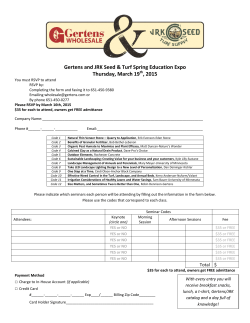

© Copyright 2025